
Hydrogeologic Framework of the Long Island Aquifer System

Detailed Description
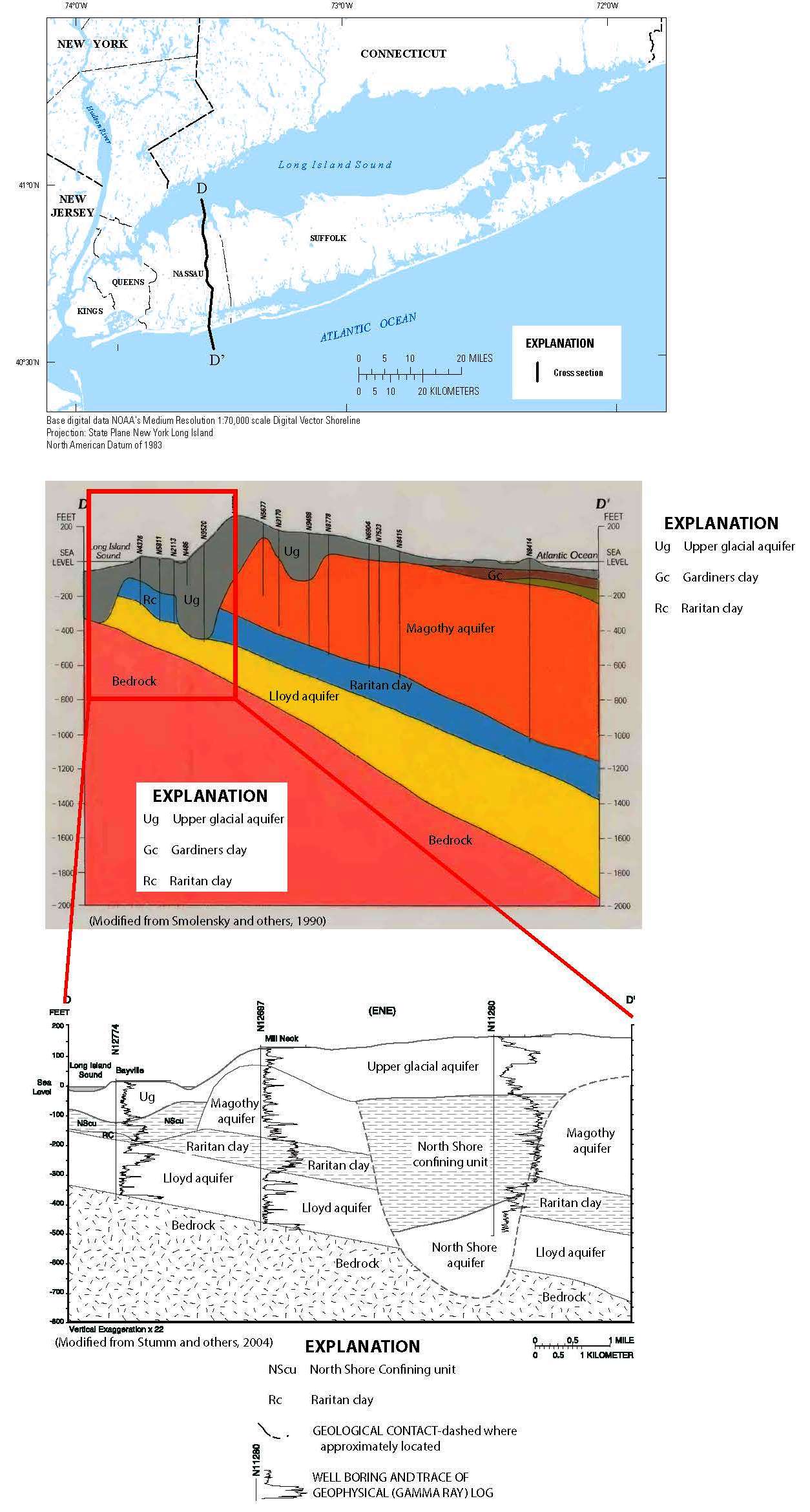
Hydrogeologic Framework of the Long Island Aquifer System: The figure above shows a hydrologic section of the Long Island aquifer system in western Nassau County, NY as delineated by Smolensky and others in 1990. This framework was developed using existing driller’s logs and well records. In 2004, the USGS installed outpost wells in the northernmost part of this hydrogeologic section and produced a much more detailed framework that indicates a more complex groundwater-flow system. Additional drilling and data collection for this study will be used to update our current understanding of the hydrogeologic framework of the Long Island aquifer system, and construct refined and higher-resolution hydrogeologic maps for most of Long Island (Public domain).
Sources/Usage
Public Domain.