
Storm tide documentation of Hurricane Sandy in New York counties
By Coastal and Marine Hazards and Resources Program
2015 (approx.)
Detailed Description
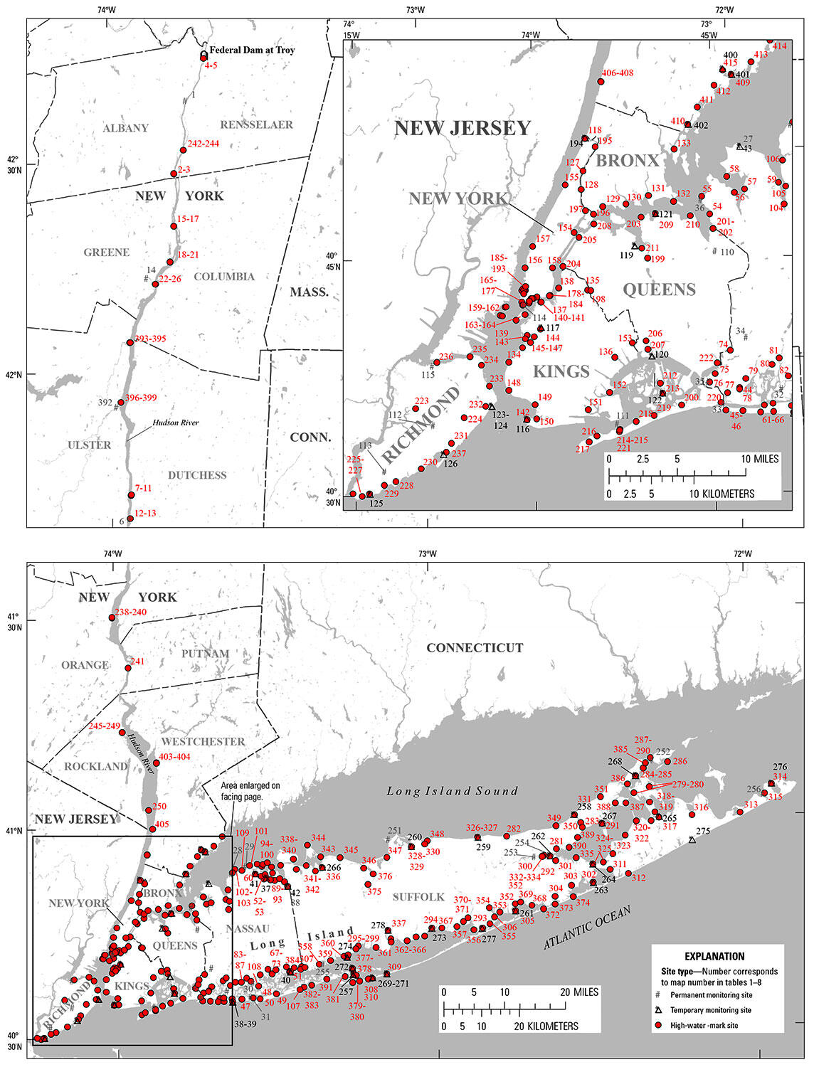
Locations of permanent and temporary monitoring sites and high-water-mark sites that documented the storm tide of Hurricane Sandy in New York counties. Inset shows enlargement of the five counties that comprise New York City—Bronx, Kings, New York, Queens, and Richmond.
Sources/Usage
Public Domain.