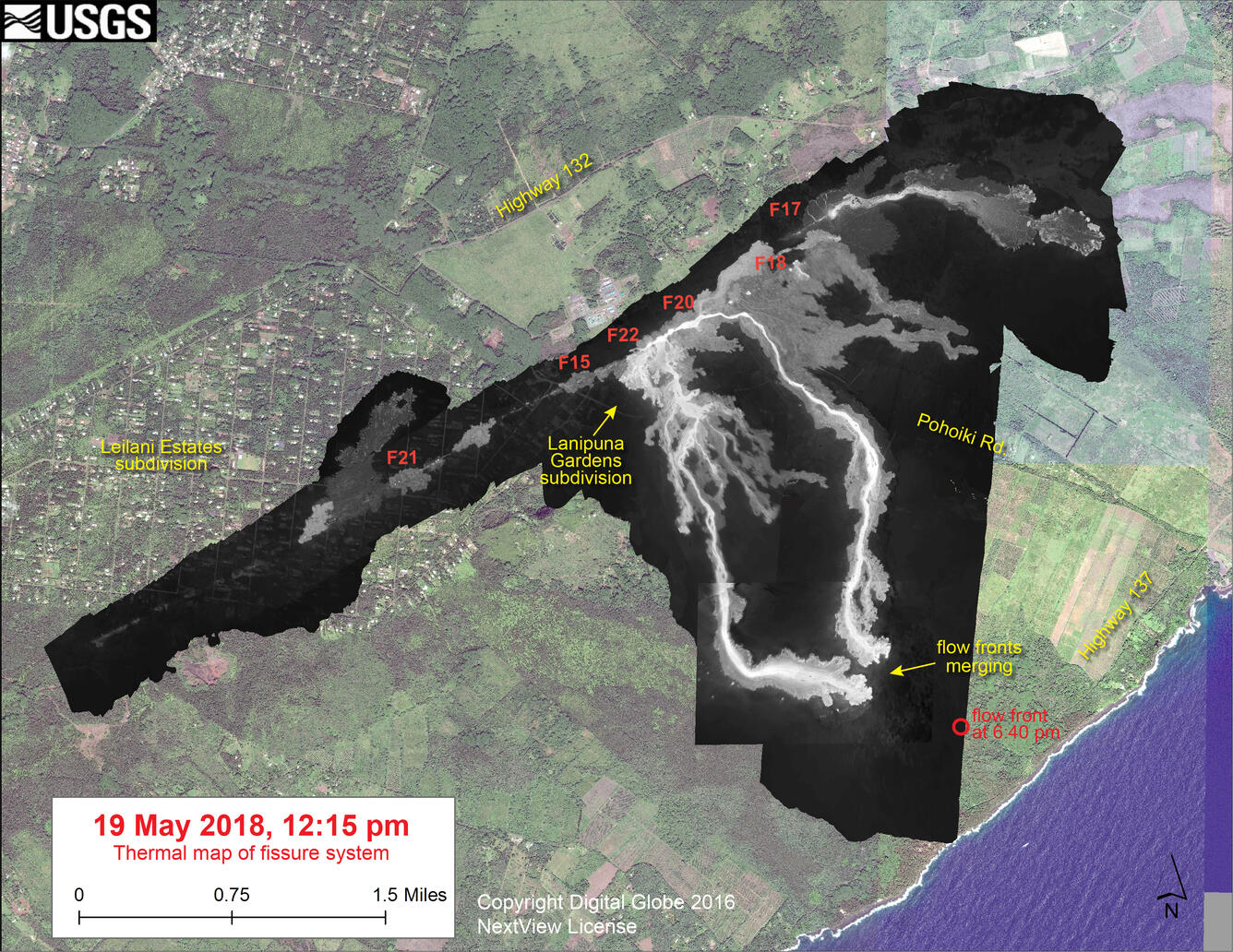
May 19—Thermal map of fissure system and lava flows
May 19, 2018
Citation Information
| Title | May 19—Thermal map of fissure system and lava flows |
|---|---|
| Record Source | USGS Publications Warehouse |

Official websites use .gov
A .gov website belongs to an official government organization in the United States.
Secure .gov websites use HTTPS
A lock () or https:// means you’ve safely connected to the .gov website. Share sensitive information only on official, secure websites.
| Title | May 19—Thermal map of fissure system and lava flows |
|---|---|
| Record Source | USGS Publications Warehouse |