
Photo Roundup - February-March 2019
A selection of coastal and marine images from across the USGS.
This article is part of the February-March 2019 issue of the Sound Waves newsletter.
Dann Blackwood, Jon Borden, and Steve Suttles of USGS ready to install moorings in Wellfleet, Massachusetts. USGS scientists measure water velocity, water quality, suspended sediment, and many other values to improve computer models of wetland changes in coastal National Park Service units, including Cape Cod National Seashore. Photo credit: USGS, February 15, 2019, public domain. More

Dann Blackwood and Jon Borden prepare to drop a current meter overboard from the research boat Muddy Waters offshore of Wellfleet, Massachusetts. Photo credit: USGS, February 15, 2019, public domain. More

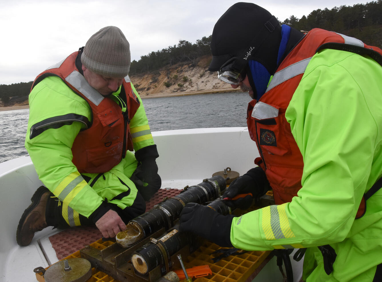
Dann Blackwood and Jon Borden inspect a current meter retrieved from the ocean using the research boat Muddy Waters near Wellfleet, Massachusetts. Photo credit: USGS, February 15, 2019, public domain. More
Shawn Harrison surveys beach topography using a precision GPS backpack on Twin Lakes State Beach, California. USGS researchers have measured coastal sediment supply and transport patterns in northern Monterey Bay for five years. Twice each year they survey the coast from Santa Cruz to Moss Landing with a variety of devices. The following photos show the scope of their operations. Photo credit: Andrew Stevens, USGS, March 7, 2017, public domain. More

Shawn Harrison surveys beach topography using a backpack equipped with precision GPS at Zmudowski State Beach, California. The fog-shrouded Moss Landing Power Plant looms in the background. More

Dan Hoover takes a break near Moss Landing, California. Dan drives the all-terrain vehicle seen behind him to rapidly survey long sections of beach using precision GPS. More

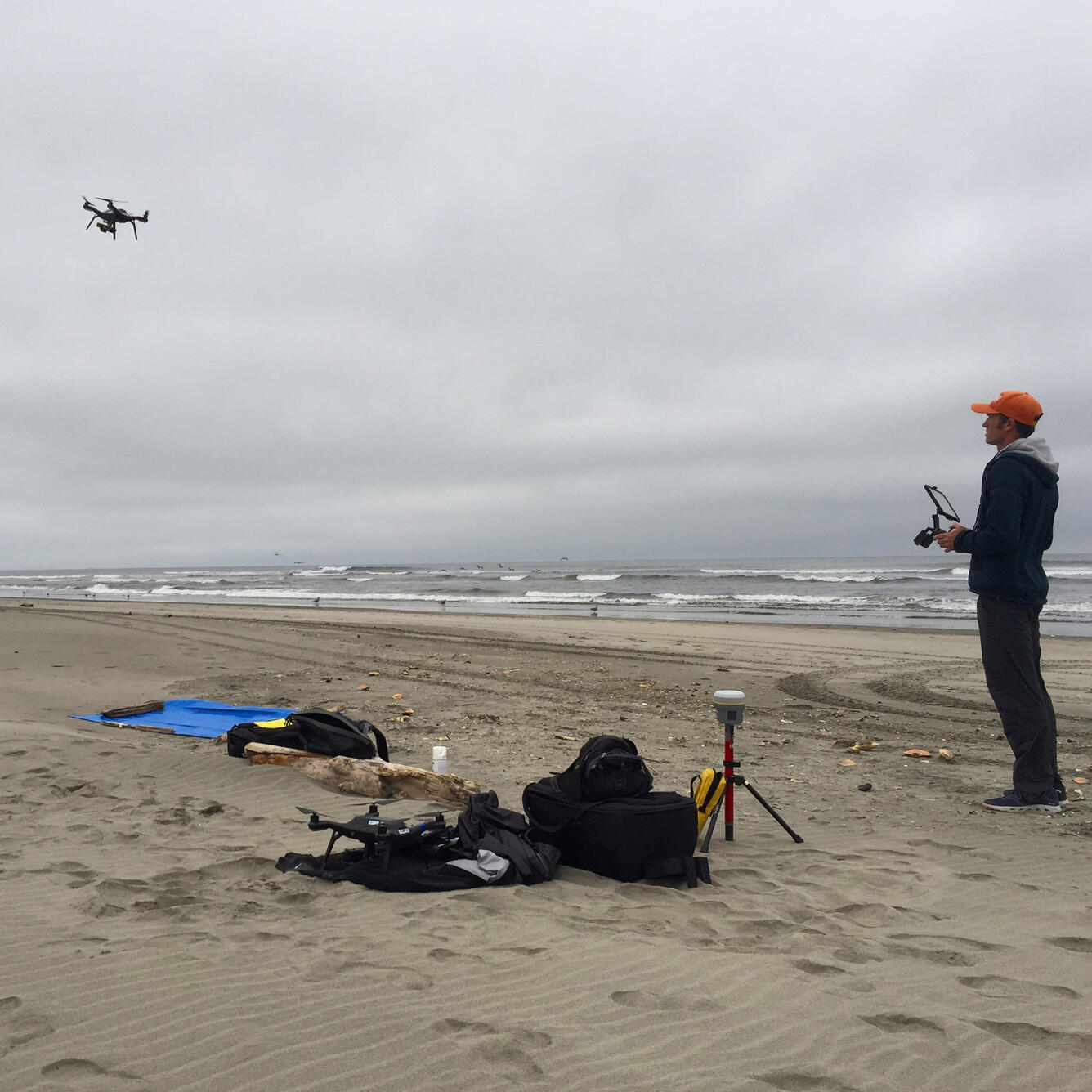
Josh Logan operates a drone carrying a precision GPS and special camera to map the shore at Long Beach, Washington. USGS scientists used the same system for detailed mapping of beaches beside Monterey Bay, California. More
Gerry Hatcher (left) and Shawn Harrison adjust a computer controlling video cameras on the roof of the Dream Inn, a 10-story hotel overlooking Monterey Bay in Santa Cruz, California. Harrison uses the images to improve understanding and computer modeling of beach processes. More

Jackson Currie maps ocean depths using a personal watercraft equipped with precision GPS and sonar near Capitola, California. More

Andrew Stevens runs a personal watercraft rigged with sonar and precision GPS to survey northern Monterey Bay, California. More

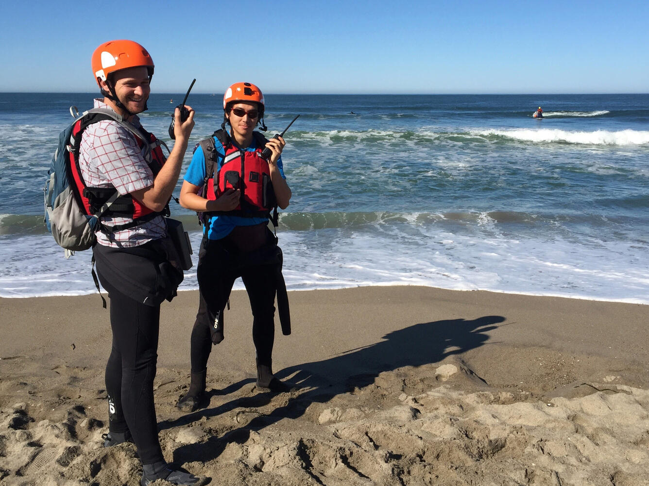
Alex Snyder (left) and SeanPaul La Selle stay in radio contact with a personal watercraft operator offshore in order to provide supplies and safety near Moss Landing, California. More
Get Our News
These items are in the RSS feed format (Really Simple Syndication) based on categories such as topics, locations, and more. You can install and RSS reader browser extension, software, or use a third-party service to receive immediate news updates depending on the feed that you have added. If you click the feed links below, they may look strange because they are simply XML code. An RSS reader can easily read this code and push out a notification to you when something new is posted to our site.