Maps and Mapping
How do I find, download, or order topographic maps?
What types of elevation datasets are available, what formats do they come in, and where can I download them?
What is a Digital Orthophoto Quadrangle (DOQ) or an orthoimage?
The USGS provides the mapping and digital geospatial foundation for the Nation.
What does "georeferenced" mean?
Georeferencing means that the internal coordinate system of a digital map or aerial photo can be related to a ground system of geographic coordinates. A georeferenced digital map or image has been tied to a known Earth coordinate system, so users can determine where every point on the map or aerial photo is located on the Earth's surface. The relevant coordinate transforms are typically stored...
Are there metadata files for USGS topographic maps?
GeoPDF files for both Historical Topographic maps (produced 1884-2006), US Topo maps (produced 2009-present), and OnDemand Topo maps come with an XML metadata file attached to each GeoPDF file. To access the metadata file, download the GeoPDF file, open it in Acrobat Reader, click on the paperclip icon, then select a file from the list that appears (US Topo maps also come with a Map Symbols...
Why are some of the historical topographic maps yellowed and why do some have extra stamps or marks?
The goals of the Historical Topographic Map Collectio n (HTMC) project are to find, catalog, and georeference all USGS topographic quadrangle maps published prior to 2007. The overall purpose is to preserve the map archive for scientists, historians, and the public. Library copies of maps (many of which have library stamps) were therefore scanned "as is". Map restoration is not part of the current...
There are multiple copies of the same map in your Historical Topographic Map Collection that all have the same date. Is there a difference between those maps?
Two or more historical topographic maps with the same date typically result from revisions and reprints. The differences are often minor. The date used to identify a map is in the lower right corner. If there are multiple editions with the same compilation date, look for additional dates in the lower right portion of the map collar that might differentiate them: Date on Map -- The year of base...
What formats are available for hydrography data products in The National Map?
Depending on the product type, hydrography data are offered in Esri File Geodatabase 10.1, Shapefile or GeoPackage formats. National Hydrography Dataset (NHD) data is available as national extracts, state extracts, 4-digit sub-regions, 8-digit sub-basins, or in a specified extent from The National Map Downloader . A national extent of medium and high resolution NHD data in File Geodatabase format...
How do I download hydrography data products?
Download USGS hydrography data (datasets representing U.S. surface water for mapping and modeling applications) using The National Map Downloader or using download links that are listed at Access National Hydrography Products . Learn more: The National Map: Hydrography Training Videos National Hydrography Dataset User Guide For streamflow data, see: Where can I get real-time and historical...
Where can I find land cover data for the U.S.?
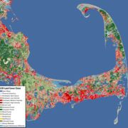
Information on land cover data from the National Land Cover Database (NLCD) is on the Multi-Resolution Land Characteristics (MRLC) website. The MRLC website serves several different vintages (dates) of the National Land Cover Database beginning with the 2001 data.
How can I find the source and vintage of each US Topo data layer?
US Topo maps have a credit legend in the lower left-hand corner of the map collar. This includes a short summary of data sources and data currency. More detailed source information is in an XML metadata file attached to each GeoPDF file. This file contains series-level, quad-level, and layer-level metadata, but US Topo does not preserve or track feature-level metadata. Open the GeoPDF map file in...
How current are US Topo maps?
US Topo maps are updated on a three-year production cycle (maps covering one third of the country are updated each year). The US Topo production schedule follows the U.S. Department of Agriculture's National Agricultural Imagery Program (NAIP) collection schedule. This does not include US Topos for Alaska, which are on a different schedule . The linework features shown on the maps are generated...
How do I get a full-scale plot of a USGS topographic map?
There are three ways to get full-scale plots of USGS topographic quadrangle maps, including H istorical Topographic maps (produced 1884-2006), U S Topo maps (produced 2009-present) or customized OnDemand Topos . Order a paper map from the USGS Store . Use the Store’s Map Locator to find the desired map.* Download a free map file and send it to a local printing business. USGS topographic maps...
What is GeoMark and do USGS topographic maps have it?
Almost all historical topographic maps and all US Topo maps produced before June of 2017 were georeferenced using software from the company TerraGo. Those maps are all GeoMark enabled. GeoMark is TerraGo's geospatial data extension to PDF markup. GeoMark allows notes and geometric objects (lines, polygons, etc.) to be added to a GeoPDF and allows these objects to be exported to GIS files. Users of...
Can I import a US Topo map into my Geographic Information System (GIS)?
Most Geographic Information System (GIS) vendors do not yet provide geospatial PDF import capabilities. US Topo maps are derived from GIS data sets and are formatted as PDF for the benefit of non-specialist users. We consider the product to be primarily an output of—rather than an input to—GIS. However, we recognize the demand for symbolized maps in GIS, and we are working on a companion product...


