
Earthquakes and faults in the San Francisco Bay area (1970-2003)
October 1, 2004
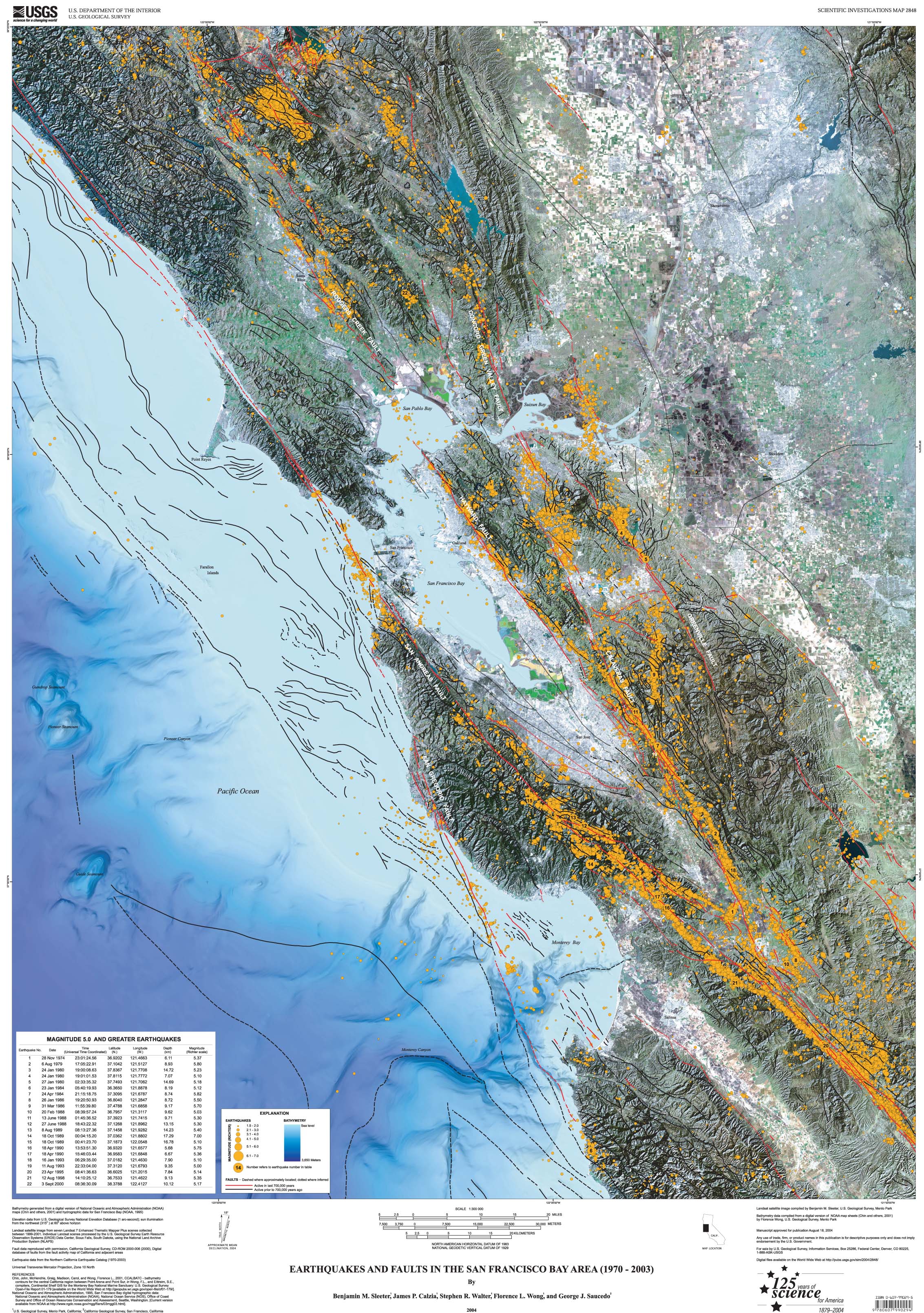
The map depicts both active and inactive faults and earthquakes magnitude 1.5 to 7.0 in the greater San Francisco Bay area. Twenty-two earthquakes magnitude 5.0 and greater are indicated on the map and listed chronologically in an accompanying table. The data are compiled from records from 1970-2003. The bathymetry was generated from a digital version of NOAA maps and hydrogeographic data for San Francisco Bay. Elevation data are from the USGS National Elevation Database. Landsat satellite image is from seven Landsat 7 Enhanced Thematic Mapper Plus scenes. Fault data are reproduced with permission from the California Geological Survey. The earthquake data are from the Northern California Earthquake Catalog.
Citation Information
| Publication Year | 2004 |
|---|---|
| Title | Earthquakes and faults in the San Francisco Bay area (1970-2003) |
| DOI | 10.3133/sim2848 |
| Authors | Benjamin M. Sleeter, James P. Calzia, Stephen R. Walter, Florence L. Wong, George J. Saucedo |
| Publication Type | Report |
| Publication Subtype | USGS Numbered Series |
| Series Title | Scientific Investigations Map |
| Series Number | 2848 |
| Index ID | sim2848 |
| Record Source | USGS Publications Warehouse |
| USGS Organization | Coastal and Marine Geology Program |
Related Content
Benjamin Sleeter
Supervisory Research Geographer
Supervisory Research Geographer
Email
Phone
Florence L Wong
Geologist Emeritus
Geologist Emeritus
Email
Phone
Related Content
Benjamin Sleeter
Supervisory Research Geographer
Supervisory Research Geographer
Email
Phone
Florence L Wong
Geologist Emeritus
Geologist Emeritus
Email
Phone