
2012 Sparrow Mapper - Midwest thumbnail
Detailed Description
Thumbnail of 2012 Sparrow Mapper - Midwest
Sources/Usage
Public Domain.
2012 Sparrow Mapper - Midwest
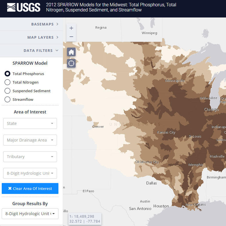
2012 SPARROW Models for the Midwest: Total Phosphorus, Total Nitrogen, Suspended Sediment, and Streamflow