
2014 U.S. Seismic Hazard Map

Detailed Description
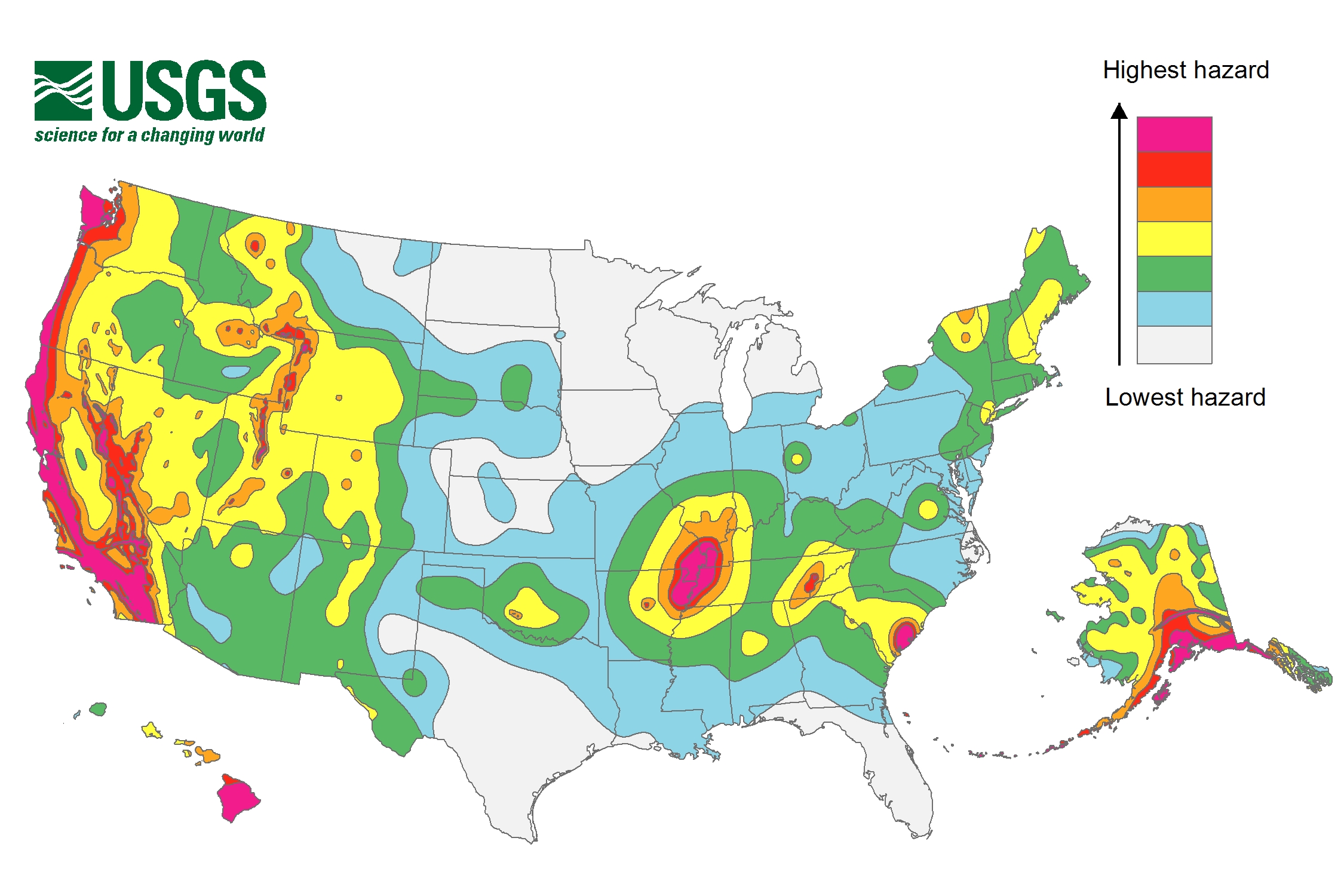
2014 U.S. seismic hazard map showing the earthquake peak ground acceleration (PGA) that has a 2% chance of being exceeded in 50 years. Red indicates the highest hazard, and gray indicates the lowest hazard.
Sources/Usage
Public Domain.