
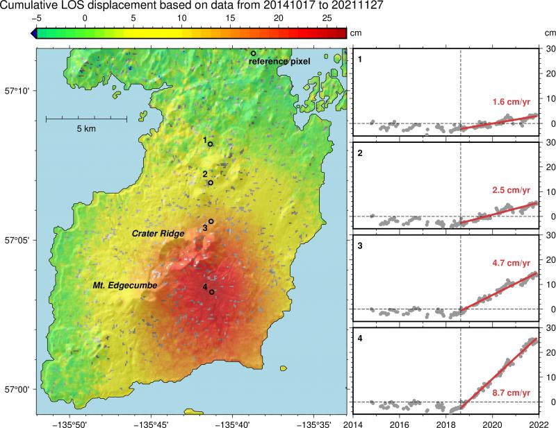
2020-2021 deformation at Mount Edgecumbe, a volcano in Alaska.

Detailed Description
Kruzof Island with Mount Edgecumbe and Crater Ridge labeled. Cumulative displacement measured in the line of sight (LOS) of Sentinel 1 radar satellites from Nov 2014-Dec 2021 (positive LOS displacement means uplift and horizontal motion toward the satellite). All deformation is given with observations at the reference pixel removed (chosen away from volcano to only capture tectonic and glacial isostatic adjustment / uplift), resulting in predominantly volcanic motion shown. Red indicates up to 27 cm of inflation. Timeseries insets show deformation over time at locations numbered 1-4 on the main map. Vertical line shows onset of inflation in Aug 2018. We observe linear inflation of up to 8.7 cm/yr since then. Figure by Yitian Cheng and Ronni Grapenthin, AVO/UAFGI
Sources/Usage
Public Domain.