
3-D Hawaii Volcanoes National Park map

Detailed Description
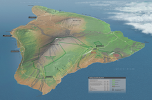
A 3-D Hawaii Volcanoes National Park map that uses a mosaic of the entire Big Island made up of 13 Landsat scenes. More information on https://landsat.gsfc.nasa.gov/national-park-service-cartographer-tom-pa…;
Sources/Usage
Public Domain.