
Backscatter, bathymetry, and hill shaded relief maps
By Woods Hole Coastal and Marine Science Center
2017 (approx.)
Detailed Description
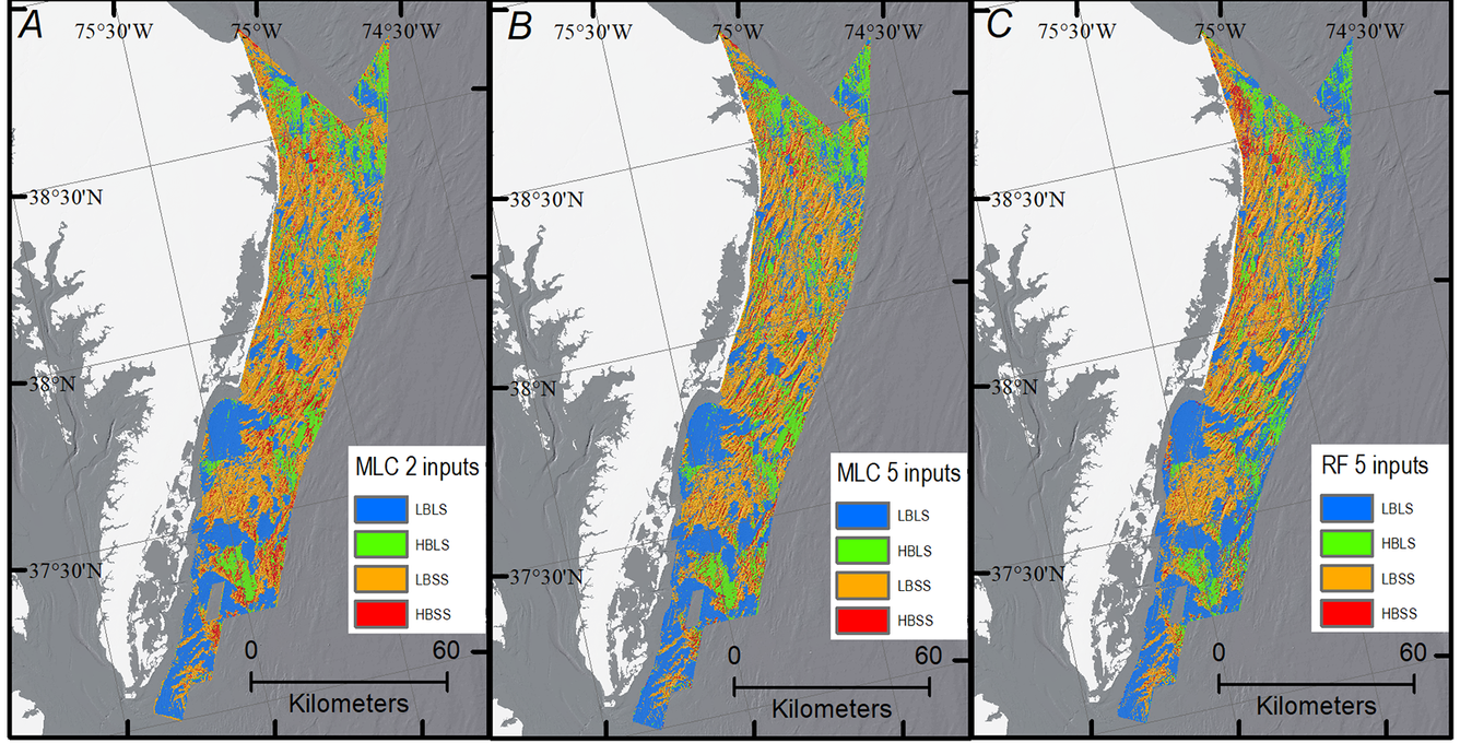
(A) Maximum Likelihood Classification (MLC) with two inputs, slope, and ISO-classified backscatter for the whole survey area. (B) MLC with five inputs, slope, ISO-classified backscatter, bathymetry, hillshaded-relief, and curvature. (C) RF with five inputs, slope, ISO-classified backscatter, bathymetry, relief, and curvature.
Sources/Usage
Public Domain.