
Cloud free map composites of the confluence of the Sacramento and San Joaquin Rivers
By Western Geographic Science Center
January 2023 (approx.)

Detailed Description
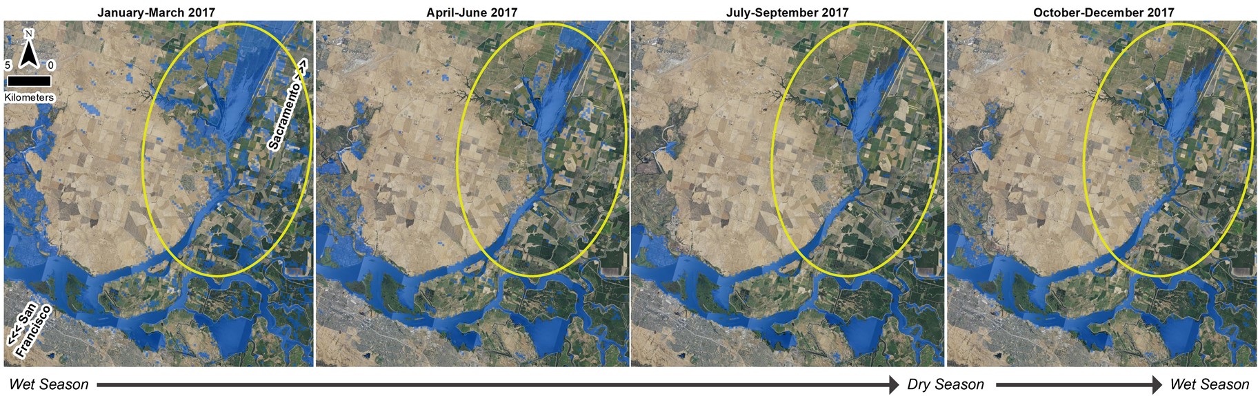
Dense stacks of images to create cloud-free map composites. In this case at the confluence of the Sacramento River and San Joaquin River in California, cloud-free composites include winter inundation and allow the team to measure seasonal surface water variability. The yellow circle highlights where surface water varies the most over the time series.
Sources/Usage
Public Domain.