
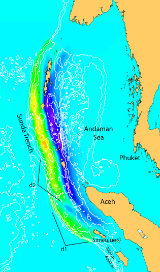
Computed vertical seafloor displacement
Detailed Description
Map of computed vertical seafloor displacement that best fits the Jason-1 satellite altimetry data. Possible source regions linked to phases d1 and d2 (double peak on satellite altimetry) are labeled. Green/yellow represents uplift. Blue/purple represents subsidence.
Sources/Usage
Public Domain.