
Deformation near South Sister from GPS data, 2001-2017
Detailed Description
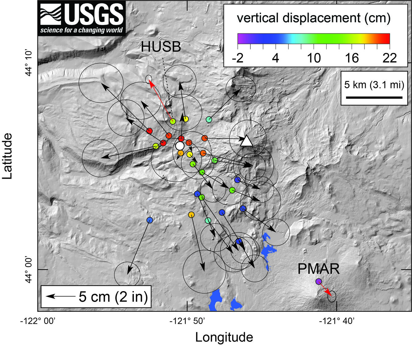
Horizontal displacements from campaign (black vectors) and continuous (red vectors, with station names given) GPS stations, as well as vertical displacements (indicated by color of GPS station symbol) near South Sister, Oregon. Length of arrow gives amount of horizontal displacement, with scale in lower left showing an arrow length indicating 5 cm (2 in) of motion. Circles at end of arrows indicate uncertainty in horizontal deformation (the arrow ends are 95% certain to lie within the associated circle). Displacements are cumulative between 2001 and 2017 based on a logarithmic fit to the time series from continuous GPS site HUSB and applied to all other campaign and continuous GPS stations. Summit of South Sister is indicated by white triangle, and white circle marks location of modeled inflation source. Figure adapted from Poland and others (2017).
Sources/Usage
Public Domain.
Figure modified from Poland and others (2017).
Related

Modern Deformation and Uplift in the Sisters Region
Related