
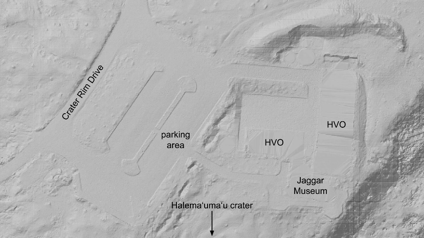
Digital elevation model from the 2019 LiDAR survey of Kīlauea
By Kīlauea
2019 (approx.)

Detailed Description
A sample of the digital elevation model from the 2019 LiDAR survey of Kīlauea, showing the vicinity of the former HVO office and Jaggar Museum in Hawaiʻi Volcanoes National Park. The buildings have been digitally “flattened” because the instrument’s light pulses are not able to penetrate structures; this flattening approximates the “bare earth” ground surface below the buildings. Otherwise, LiDAR data captures minute details, such as the elevated curbs in the parking area.
Sources/Usage
Public Domain.