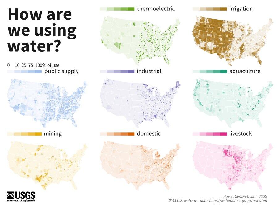
Distributions: humans - How are we using water?

Detailed Description
8 maps of the continental U.S. show county-level water use for 8 categories of use – thermoelectric, irrigation, public supply, industrial, aquaculture, mining, domestic, and livestock. Use in each category is shown as a percent of total water use, by county. In the northern plains, most water is used for livestock. In west Texas, most water is used for mining. In northern Maine, most water is used for industry.
Sources/Usage
Public Domain.

