
DSAS
By Woods Hole Coastal and Marine Science Center
April 2024 (approx.)
Detailed Description
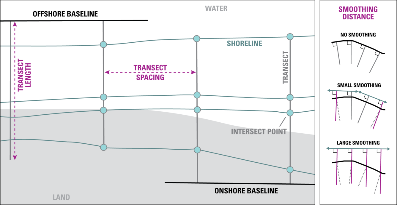
DSAS generates transects that are cast perpendicular to the reference baseline to intersect shorelines at a user-specified spacing alongshore. Please note that the figure above illustrates the placement of both onshore and offshore baselines as examples. In DSAS v6.0 all baselines in a file must be placed either offshore or onshore, not combined.
DSAS measures the distance between the baseline and each shoreline intersection along a transect, and combines date information, and positional uncertainty for each shoreline, to generate the following change metrics (see DSAS v.5.1 user guide for more detail)
Sources/Usage
Public Domain.
Related

Digital Shoreline Analysis System (DSAS)
Software for calculating positional boundary change over time The Digital Shoreline Analysis System (DSAS) version 6 is a standalone application that calculates shoreline or boundary change over time. The GIS of a user’s choice is used to prepare the data for DSAS. Like previous versions, DSAS v.6 enables a user to calculate rate-of-change statistics from multiple historical shoreline positions...
Related
Digital Shoreline Analysis System (DSAS)
Software for calculating positional boundary change over time The Digital Shoreline Analysis System (DSAS) version 6 is a standalone application that calculates shoreline or boundary change over time. The GIS of a user’s choice is used to prepare the data for DSAS. Like previous versions, DSAS v.6 enables a user to calculate rate-of-change statistics from multiple historical shoreline positions...