
EO-1 Tsunami Acquisitions
By Earth Resources Observation and Science (EROS) Center
2005 (approx.)

Detailed Description
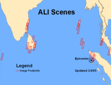
The acquisition maps for the EO-1 Advanced Land Imager (ALI) sensor reveals the spatial location of the scenes within the Indian Ocean tsunami region.
Sources/Usage
Public Domain.