
Field Work at Keller Well

Detailed Description
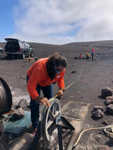
HVO geologists measure the depth to the water table at the Keller Well, located south of Halema‘uma‘u crater. The Keller Well is a borehole drilled in 1973 to a depth of 4,140 ft (1,262 m) that has been used to monitor the hydrology of the summit region of Kīlauea volcano. Photo taken on July 27, 2021, at 9:30 a.m. HST. USGS photo by J.M. Chang.
Sources/Usage
Public Domain.