
This Flood Event Viewer is a one-stop information source

Detailed Description
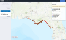
The USGS creates a Flood Event Viewer for major flooding incidents, as a one-stop, interactive information source. On that website, viewers can click on each red dot (storm-tide sensor) to see details about it. The Flood Event Viewer for Hurricane Michael is at https://stn.wim.usgs.gov/FEV/#MichaelOct2018
Sources/Usage
Public Domain.