
Gathering topographic data to map a changing beach

Detailed Description
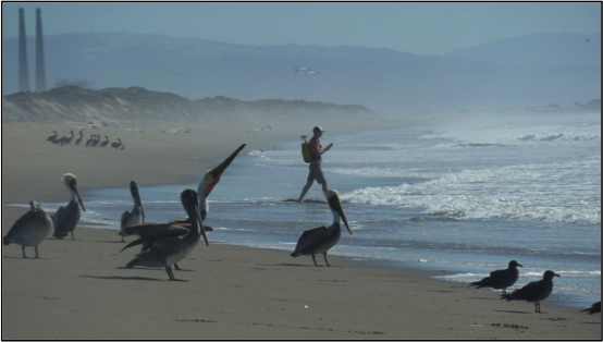
USGS scientist, Alex Snyder gathers topographic data by walking beach transects northwest of Moss Landing, California to help researchers understand how Monterey Bay will respond to changing environmental conditions.