
Geospatial products generated from UAS-acquired imagery
Detailed Description
Geospatial products generated from UAS-acquired imagery:
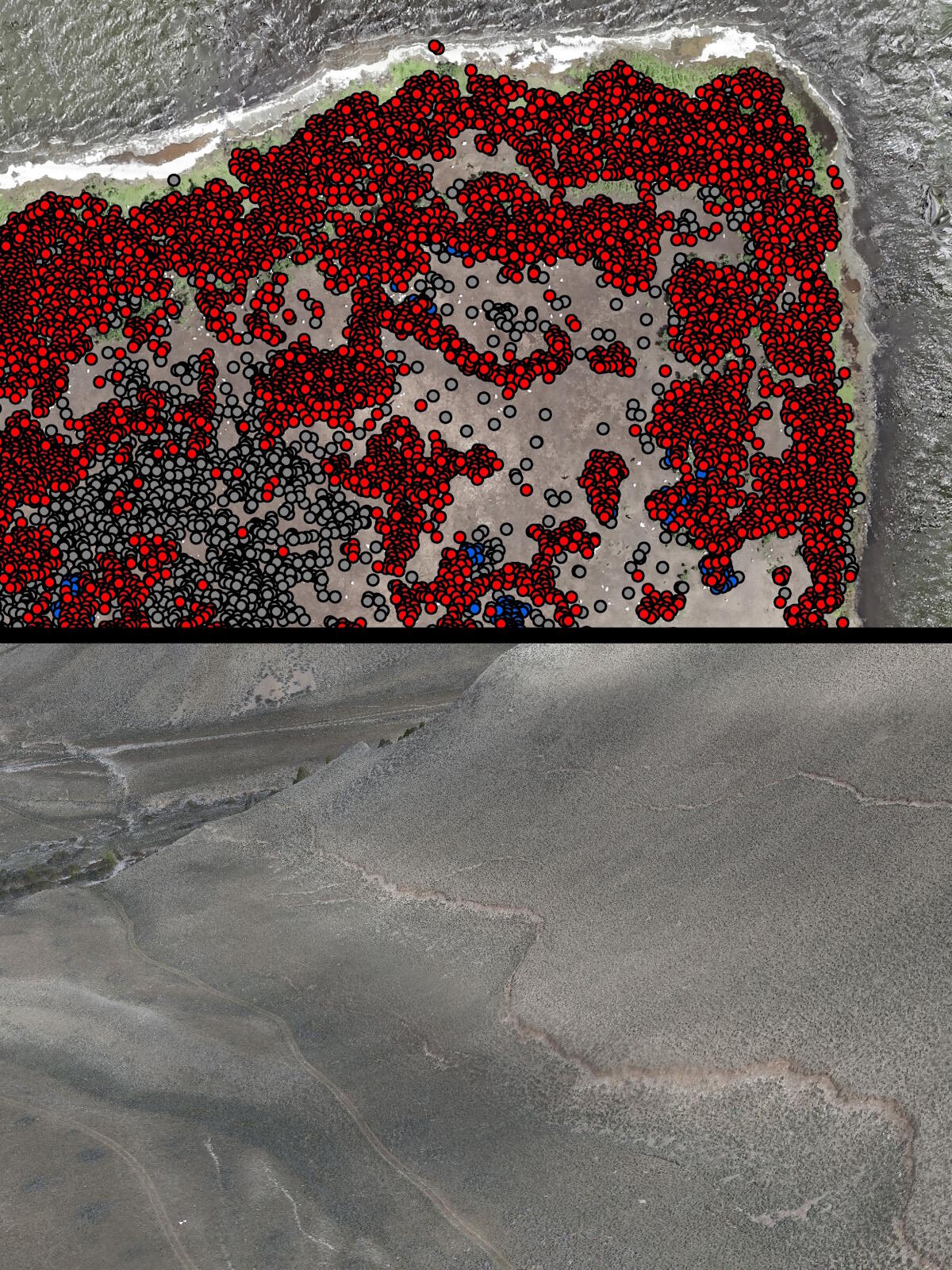
Portion of a natural color orthomosaic overlaid with the feature extracted locations of nesting American White Pelicans (red), Cormorants (blue), and Other (black) in North Dakota’s Chase Lake National Wildlife Refuge derived from UAS-acquired imagery (top).
Natural color 3D model that shows the ground disruptions caused by Idaho’s Borah Peak earthquake, created by overlaying dense point cloud data on an orthomosaic that were both generated from UAS-acquired natural color imagery (bottom).
Feature extraction techniques utilize automated processes that recognize spatial and spectral patterns within an image and then outlines or classifies those recognized features to produce a new dataset. Feature extraction techniques that make use of the high-resolution imagery generated from low-altitude UAS collection allows for the accurate identification of <1 meter small-scale (birds or other animals) to >1 meter larger-scale objects (tree crowns).
Point clouds are a set of geographic data points in a three-dimensional coordinate system derived by either SfM processing techniques (photogrammetrically from overlapping raster images) or collected directly by lidar sensors. True-color point clouds can be generated by either processing the natural color imagery in SfM software or combining this imagery with the lidar data collected directly from the same location. The point cloud data derived from either UAS-acquired imagery or lidar data provides a source of highly accurate elevation data which can then be used to generate contour lines and 3D digital elevation models (DEMs), a generic term for digital terrain model (DTMs) and digital surface models (DSMs).
Sources/Usage
Public Domain.