
GFSAD30 Figure C2

Detailed Description
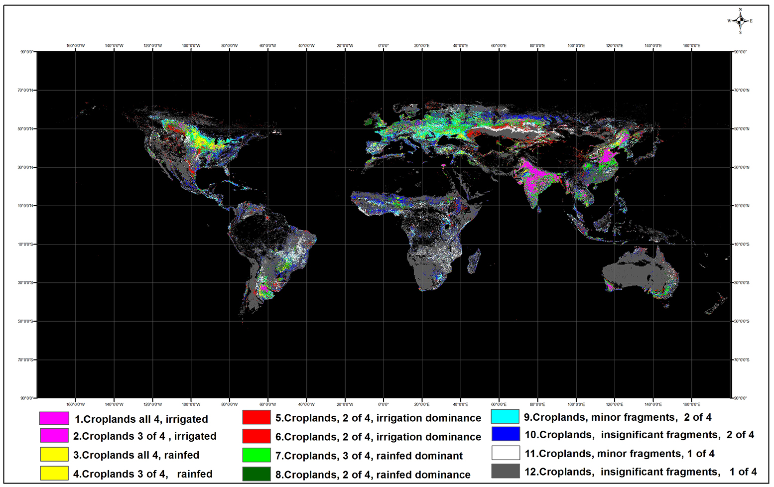
A disaggregated twelve class global cropland extent map derived at nominal 1-km based on four major studies: Thenkabail et al. (2009a, 2011), Pittman et al. (2010), Yu et al. (2013) and Friedl et al. (2010). Classes 1-9 are cropland classes and show the dominance of irrigated and rainfed agriculture. Classes 10-12 have minor/very minor fractions of croplands.
Sources/Usage
Courtesy: Dr. Prasad Thenkabail