GIS data layers visualization
Detailed Description
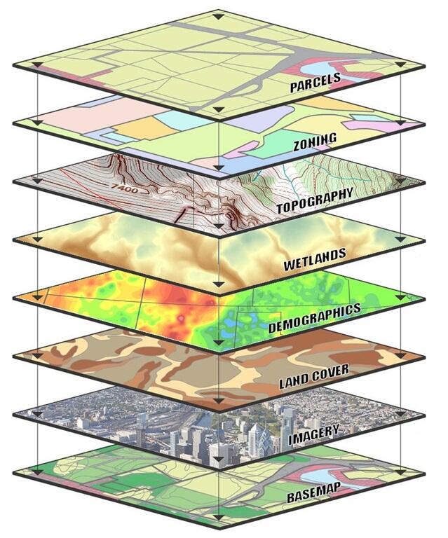
Temporal and spatial inputs are necessary to conduct the proposed modeling.Potential model covariates could include land cover, temperature, precipitation, etc. Image Credit Ontario County, NY

Official websites use .gov
A .gov website belongs to an official government organization in the United States.
Secure .gov websites use HTTPS
A lock () or https:// means you’ve safely connected to the .gov website. Share sensitive information only on official, secure websites.
Temporal and spatial inputs are necessary to conduct the proposed modeling.Potential model covariates could include land cover, temperature, precipitation, etc. Image Credit Ontario County, NY