
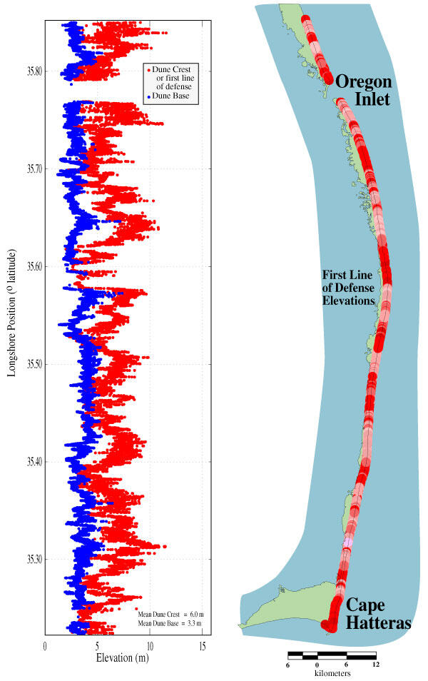
Graph of the elevations of the dune crest and the dune base
Detailed Description
Graph of the elevations of the dune crest and the dune base along Cape Hatteras National Seashore. The gap in data near the top of the graph corresponds with the position of Oregon Inlet. Note the spatial variability along the coast. Lower first line of defense elevations (red) are vulnerable to overwash and inundation regimes. Coasts with lower dune base elevations (blue) are vulnerable to the collision regime and dune retreat. The dune elevation map to the right of the graph covers the same stretch of the Cape Hatteras National Seashore and the vertical scale of dune elevation corresponds to the North Carolina map.
Sources/Usage
Public Domain.