
Head of the Meadow Beach
By Woods Hole Coastal and Marine Science Center
February 2021 (approx.)
Detailed Description
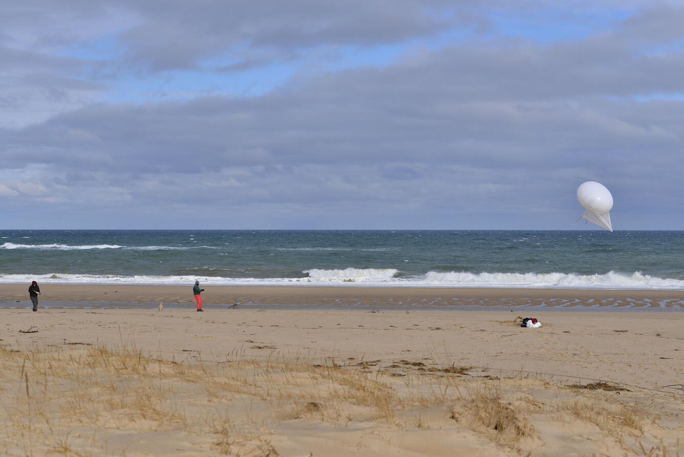
Scientists from the USGS Woods Hole Coastal and Marine Science Center using a helium powered kite-balloon at Head of the Meadow Beach and Marconi Beach, Cape Cod National Seashore in Massachusetts. A camera is attached to the kite and taken up and down the beach to take a bunch of pictures used to create a digital elevation model with structure-from-motion techniques. Remote sensing technologies such as this are used to measure coastal change along U.S. shorelines. This research will improve computer-derived simulations of coastal flooding and shoreline change that communities can use to plan for sea-level rise, changing storm patterns, and other threats to beaches.
Sources/Usage
Public Domain.