
Hunga Tonga-Hunga Haʻapai
By Pacific Coastal and Marine Science Center
2014 (approx.)
Detailed Description
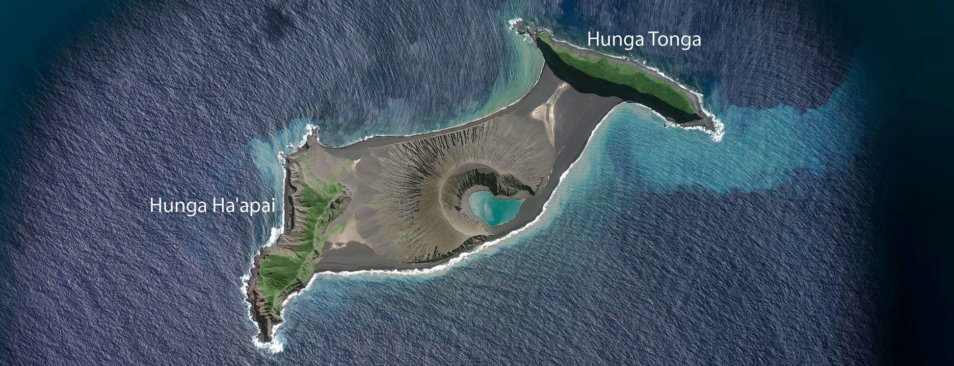
Satellite image of the uppermost part of the underwater volcano of Hunga Tonga. The island has a length of about 3.5 km and is 1.7 km wide. It was formed in late December 2014 by a volcanic eruption that joined two separate islets, Hunga Tonga and Hunga Ha'apai, into a single landmass.
Sources/Usage
Public Domain.