
Hurricane Katrina Before and After Photos
Detailed Description
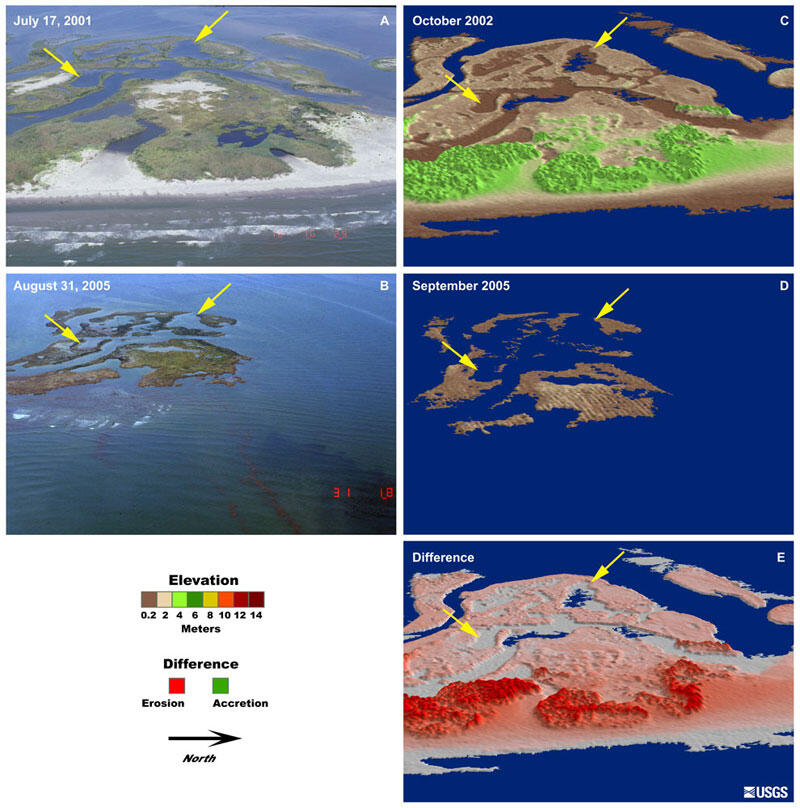
Pre- (A) and post-storm (B) photography reveal the dramatic changes that occurred along the entire stretch of islands. This loss of sand and marsh is quantified using lidar topographic surveys (C and D). The elevation difference (E) between the two surveys reveal erosion over the entire island. This is in contrast to the erosion/accretion patterns typical of the overwash regime, in which a barrier island slowly migrates inland. This extreme coastal change may lead to long-term, permanent changes in the barrier island morphology and may affect its future resilience in storms.
Sources/Usage
Public Domain.
Related

Storm-Impact Scale
The potential vulnerability of a particular stretch of coast can be assessed using a conceptual model that scales the impacts of storms on barrier islands.
Related
Storm-Impact Scale
The potential vulnerability of a particular stretch of coast can be assessed using a conceptual model that scales the impacts of storms on barrier islands.