
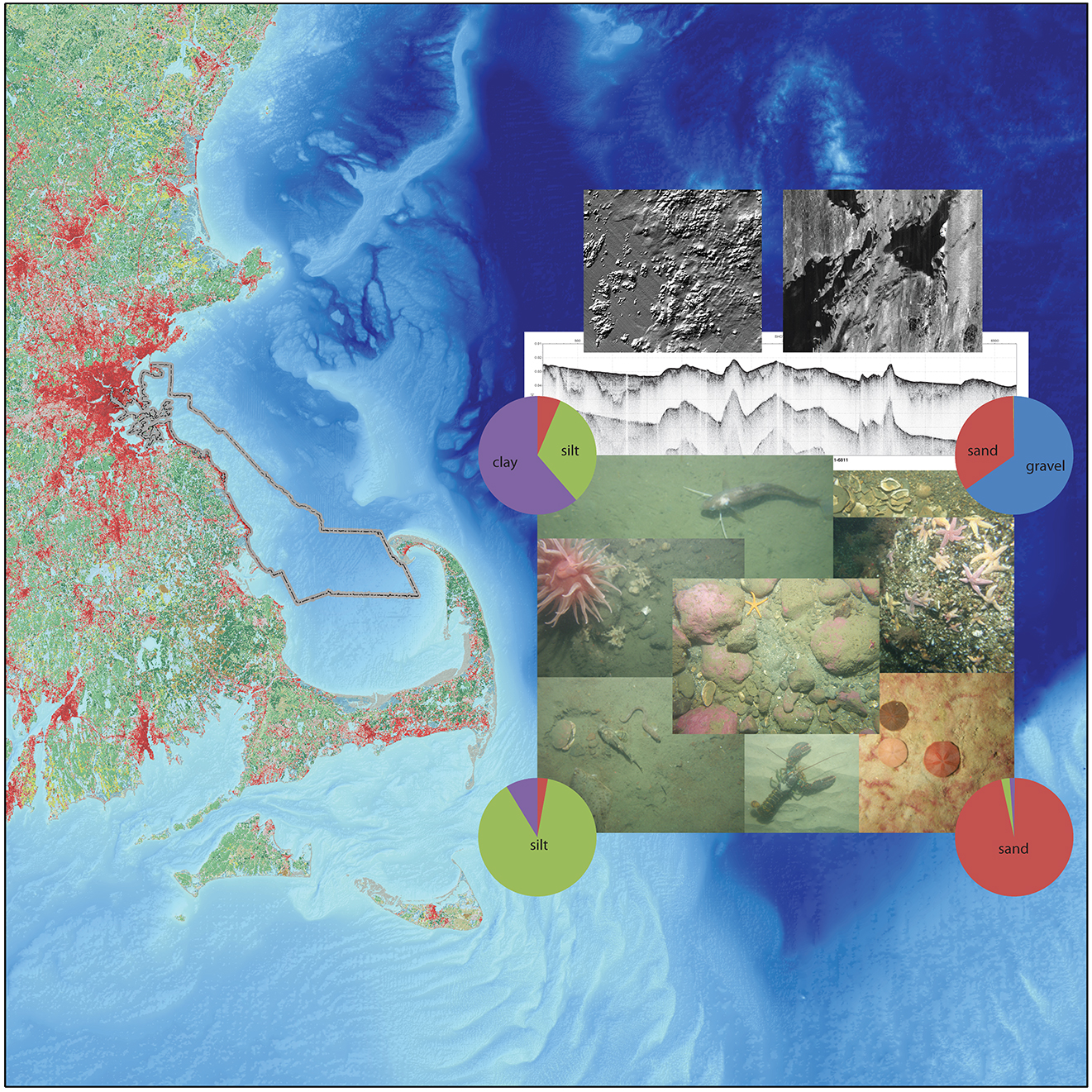
Image showing a study area from Boston Harbor to the mouth of Cape Cod
By Woods Hole Coastal and Marine Science Center
2012 (approx.)

Detailed Description
Image showing a study area from Boston Harbor to the mouth of Cape Cod Bay including some images of geophysical and sample data available in the associated report.
Sources/Usage
Public Domain.
Related

Geologic Mapping of the Massachusetts Seafloor
The U.S. Geological Survey, in cooperation with the Massachusetts Office of Coastal Zone Management (CZM) is conducting geologic mapping of the sea floor to characterize the surface and shallow subsurface geologic framework within the Massachusetts coastal zone. The long-term goal of this mapping effort is to produce high-resolution geologic maps and a Geographic Information System (GIS) that will...
Related
Geologic Mapping of the Massachusetts Seafloor
The U.S. Geological Survey, in cooperation with the Massachusetts Office of Coastal Zone Management (CZM) is conducting geologic mapping of the sea floor to characterize the surface and shallow subsurface geologic framework within the Massachusetts coastal zone. The long-term goal of this mapping effort is to produce high-resolution geologic maps and a Geographic Information System (GIS) that will...