
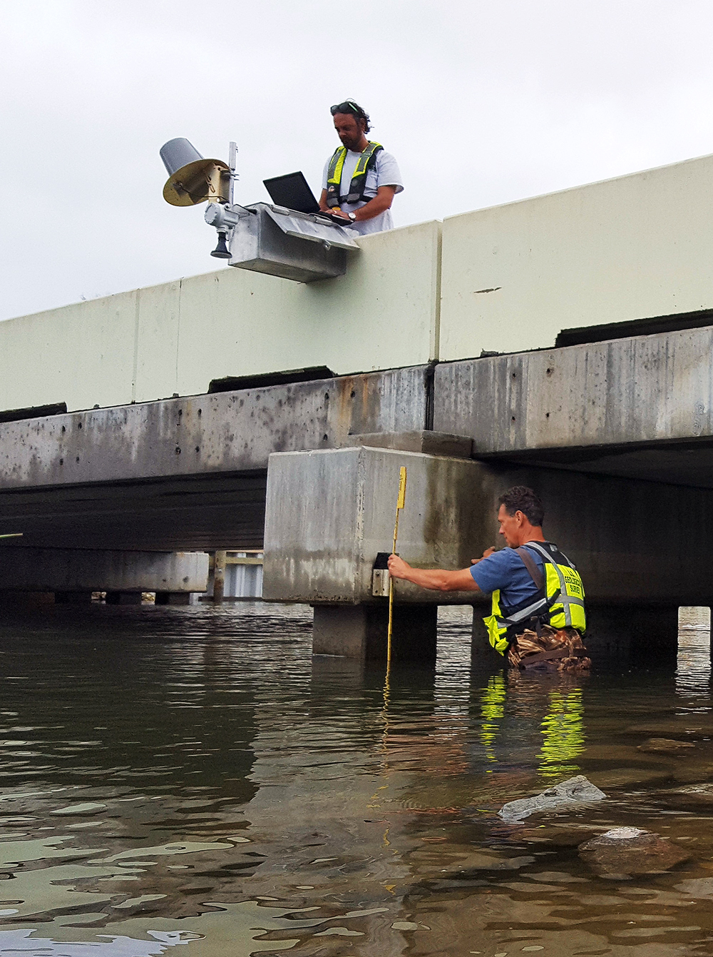
Installing a rapid deployment gauge to track Hurricane Matthew impacts
By Communications and Publishing
October 2016 (approx.)

Detailed Description
USGS hydrologic technician Jym Chapman (above) installs a rapid deployment gauge to measure water-surface elevation and other data in Myrtle Beach, South Carolina, prior to Hurricane Matthew’s approach in October 2016. Hydrologist Tim Pojunas (below) measures an elevation reference point used to calibrate the newly installed RDG. The data collected by RDGs are transmitted in real time by satellite, and are used for flood forecasting and emergency response. Photo by Chris Henry, USGS.
Sources/Usage
Public Domain.