
Isotopes in Rocky Mountain Snowpack Network Sampling Sites
By Land Change Science Program
2016 (approx.)
Detailed Description
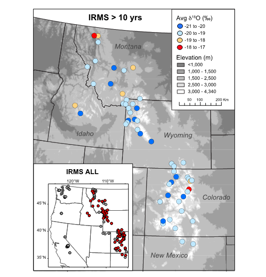
Sampling locations for the Isotopes in Rocky Mountain Snowpack (IRMS) Network shown on a gray shaded DEM. Color scale indicates average snowpack δ18O for 57 locations with >10 years of data (in red on the inset, which shows all 177 IRMS locations). (From Figure 1 in Anderson et al., 2016)
Sources/Usage
Public Domain.