
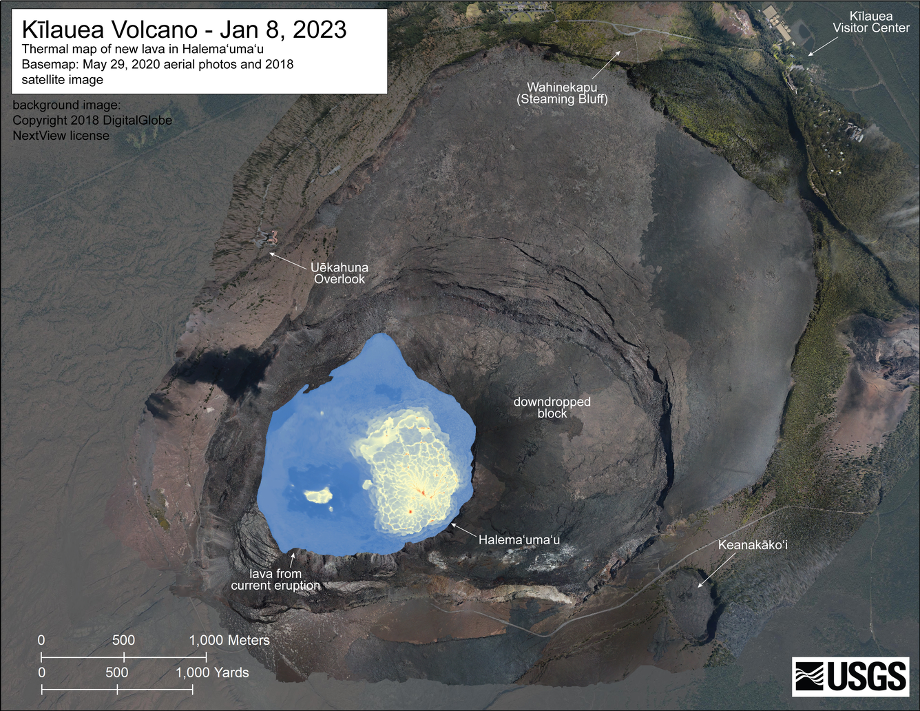
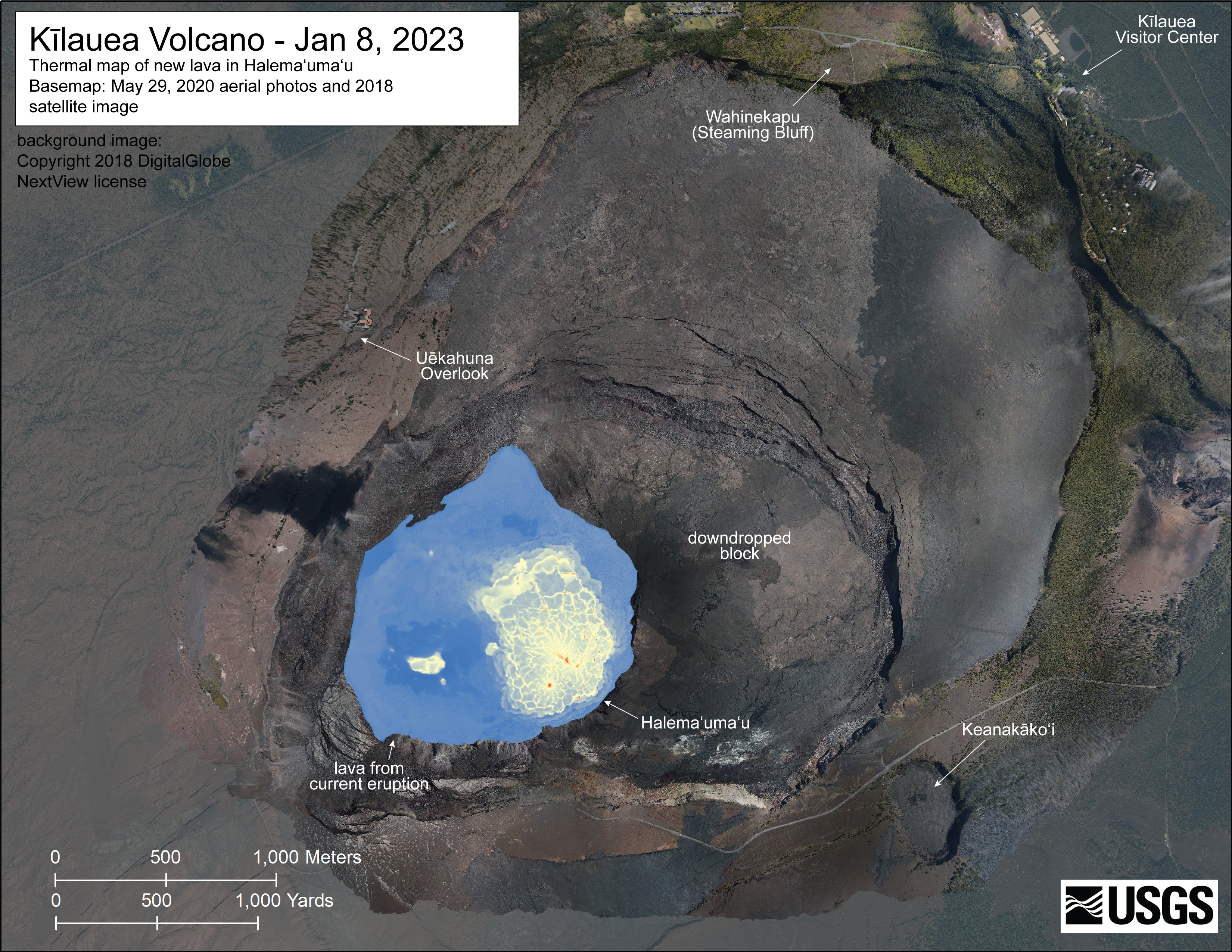
January 8, 2023 — Kīlauea summit thermal map
Detailed Description
A helicopter overflight on January 8, 2023, allowed for aerial visual and thermal imagery to be collected of Halema‘uma‘u crater at the summit of Kīlauea. The active vents are located in the eastern portion of the crater, though lava has also filled the areas previously active in the western portion of the crater. The scale of the thermal map ranges from blue to red, with blue colors indicative of cooler temperatures and red colors indicative of warmer temperatures.
Sources/Usage
Public Domain.