
Kīlauea's eruptions offer picturesque viewing opportunities
Detailed Description
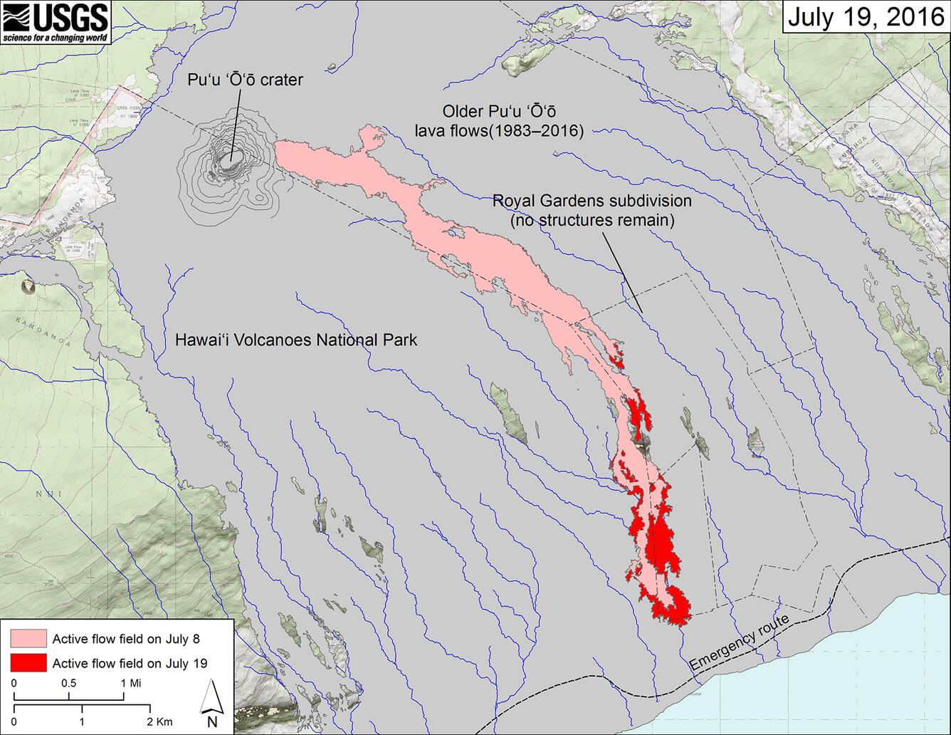
Map of Kīlauea's active lava flow as of July 19, 2016. Red shows the extent of new breakouts since July 8; pink shows the flow prior as of July 8, and gray shows areas covered by earlier Pu‘u ‘Ō‘ō lava flows (1983-2016). As of July 20, the flow front was about 850 m (0.5 mi) from the ocean and making little forward progress, but active lava breakouts upslope of the flow front continued to widen the flow margins. USGS map.
Sources/Usage
Public Domain.