
L7 Radome 2b
By EROS History Project
1999 (approx.)
Detailed Description
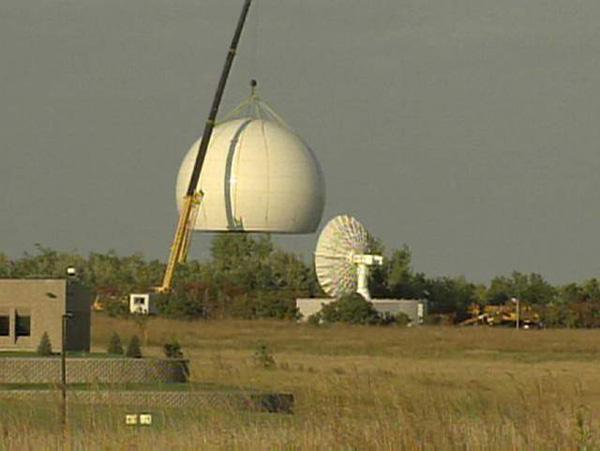
Lowering of the dome over the Landsat 7 antenna for final installation in September 1999. EROS History Project
Sources/Usage
Public Domain.