
Land Surface Position, Cuyama Valley, CA

Detailed Description
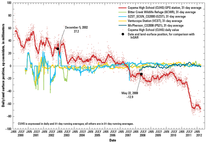
Land-surface position, up coordinate, in millimeters, for the GPS stations Cuyama High School (CUHS), Ventucopa Station (VCST), McPherson_CS2008 (P521), Bitter Creek Wildlife Refuge (BCWR), and OZST_SCGN_CS2000 (OZST), Cuyama Valley, Santa Barbara County, California. The measured displacement at CUHS between December 5, 2002, and May 22, 2008, was -40 mm. It is likely that this downward trend, or subsidence, represents inelastic deformation and indicates compaction and reduced storage capacity of the aquifer sediments; a significant component ofthe seasonal fluctuations represented elastic deformation, as evidenced by various periods of partial recovery.