
Land Treatment Exploration Tool
Detailed Description
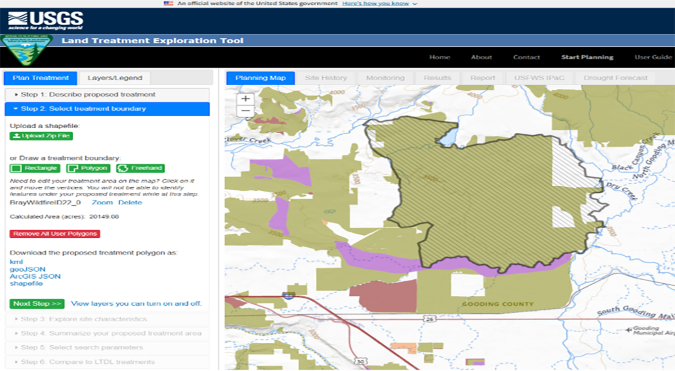
The Land Treatment Exploration Tool starts with the user identifying a name and treatment type for the proposed land treatment. Step 2, shown here, requires that the user upload or draw a treatment boundary. The user can edit, delete, and zoom to the drawn boundary(s). They can also download the proposed treatment boundary for use in other maps and GIS applications.
Sources/Usage
Public Domain.