
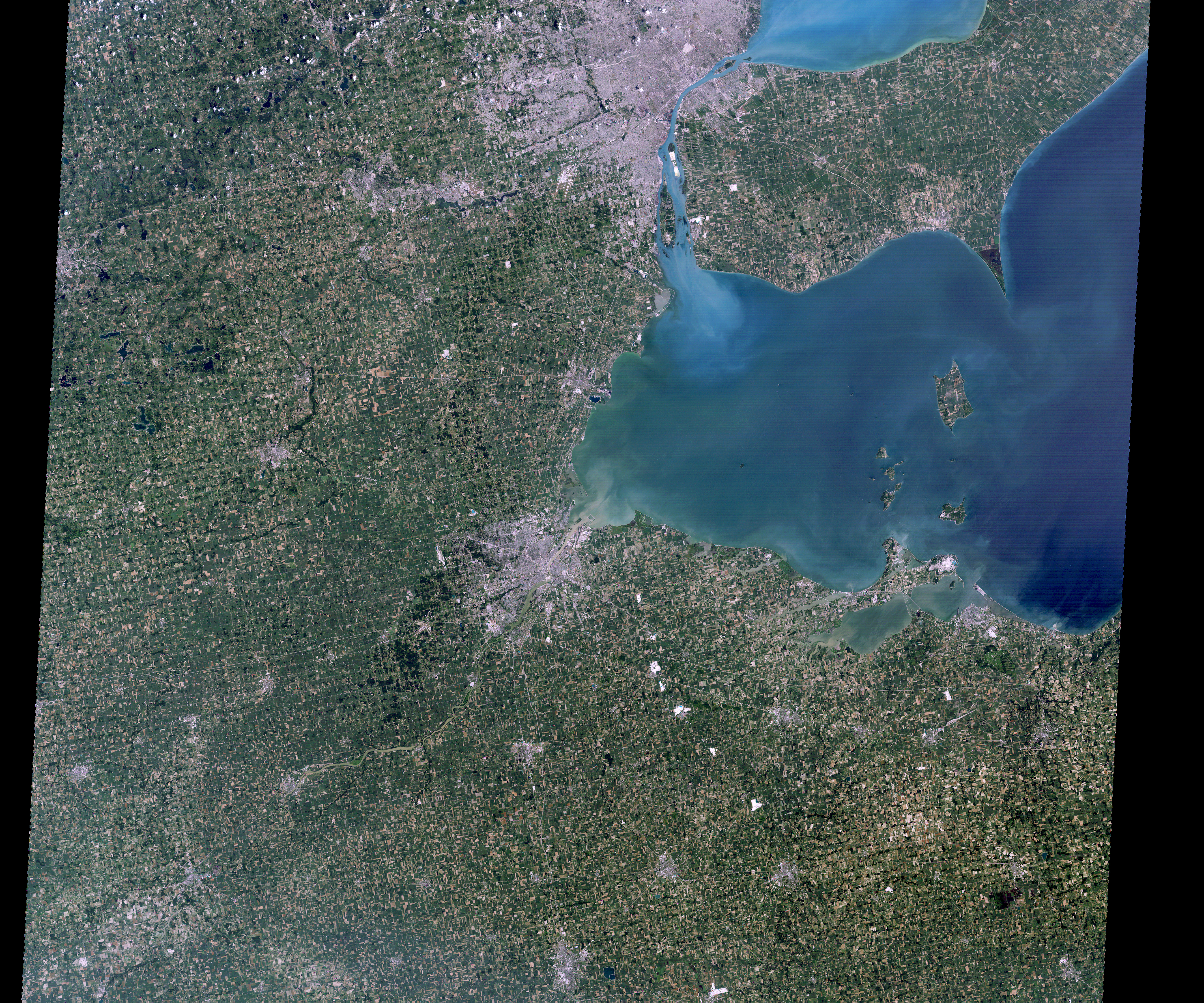
Landsat 4 First Light Image over western Lake Erie

Detailed Description
Landsat 4's first light image captured eastern Lake Erie, and the cities of Toledo, Detroit, and Windsor on July 25, 1982. Although the Landsat program had been collecting images of the Earth since 1972, this was the first time that the data could be depicted as a natural color image due to the new Thematic Mapper sensor onboard Landsat 4. The Thematic Mapper not only had an increased spectral resolution but an improved geometric resolution as well.
Wonder why this image looks different than a typical Landsat Scene? This data is classified as Landsat scrounge data. The original data processing system developed by General Electric was not ready in time to process new Landsat 4 data, so an alternative processing system was developed at NASA Goddard, known as the “scrounge system”. The system processed one TM scene per day and was in use for a year after launch until a more sophisticated system came online.
Learn more on the Landsat 4 web page
Sources/Usage
Public Domain.
Related Content

Landsat 4 First Light Image of Detroit
The first Landsat 4 image was acquired over western Lake Erie on July 25, 1982, just 9 days after launch. This image shows the Detroit River dividing the metropolitan areas of Detroit, Michigan and Windsor, Ontario while acting as a strait between Lake Erie and Lake St. Clair.
Related Content
Landsat 4 First Light Image of Detroit
The first Landsat 4 image was acquired over western Lake Erie on July 25, 1982, just 9 days after launch. This image shows the Detroit River dividing the metropolitan areas of Detroit, Michigan and Windsor, Ontario while acting as a strait between Lake Erie and Lake St. Clair.