
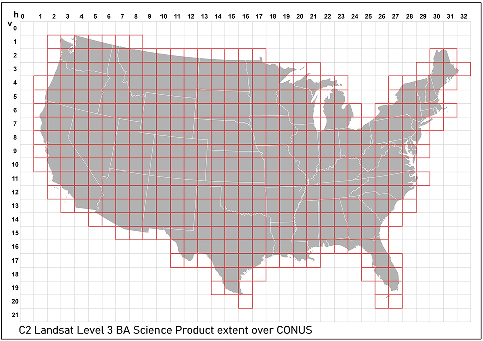
Landsat Collection 2 Level-3 Burned Area Extent Map

Detailed Description
This map of the Conterminous United States (CONUS) shows in red the tiles that are included in Landsat Collection 2 (C2) Burned Area product generation.
Sources/Usage
Public Domain.