
LCMAP Landcover Change - 2011 Tornadoes
By Land Change Monitoring, Assessment, and Projection
2011 (approx.)

Detailed Description
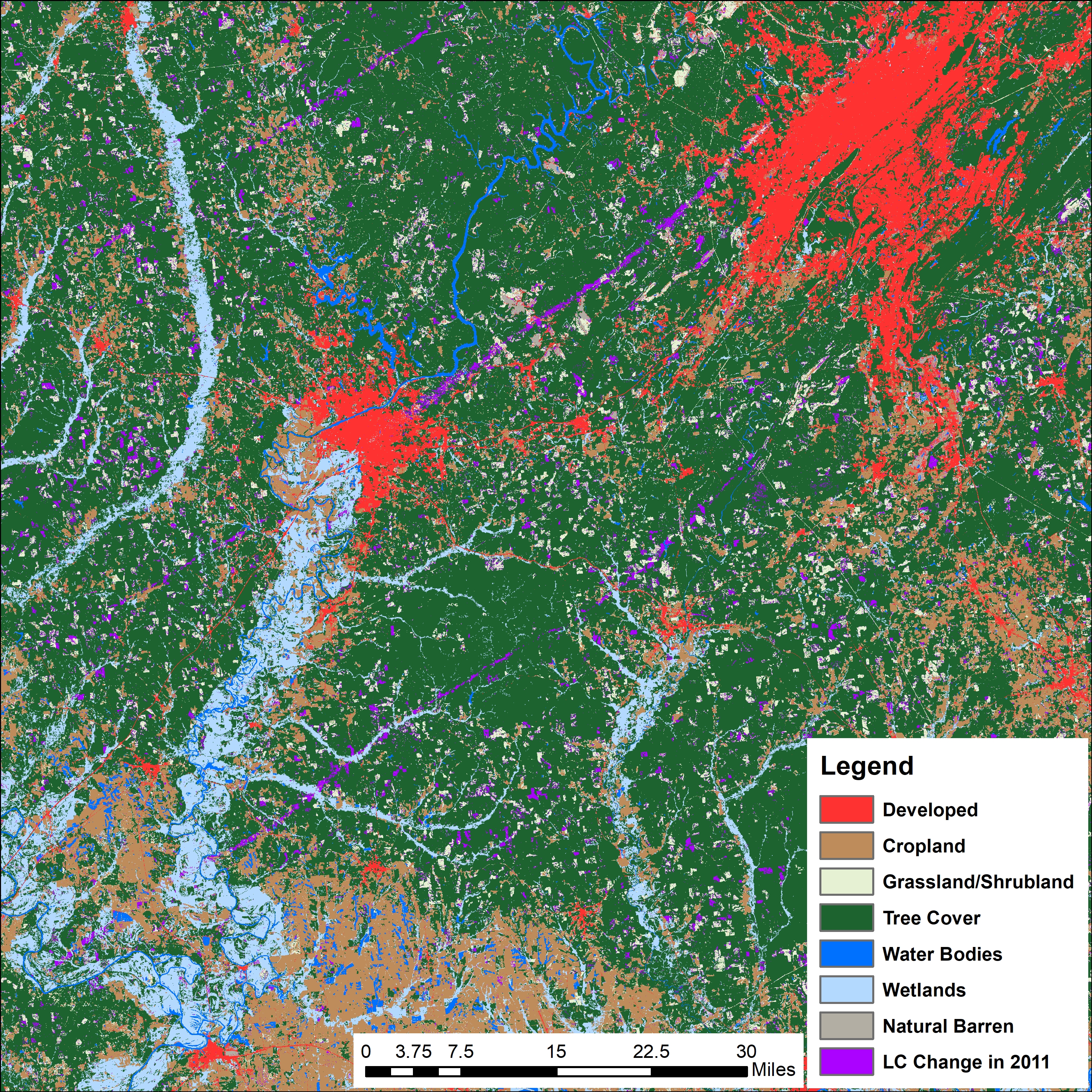
This image shows the impact of tornadoes that struck the Tuscaloosa and Birmingham, Alabama area on April 27, 2011, as captured by USGS LCMAP’s Landcover Change product. The Birmingham area is represented by the large red area in the upper right of the image, classified as “developed.”
Tuscaloosa is visible as a red area closer to the center of the image. The long purple streaks mark changes to the landscape, which coincide with the track of the tornadoes.
Sources/Usage
Public Domain.