
Liquefaction Potential Bay Area
By Earthquake Hazards Program
2021 (approx.)
Detailed Description
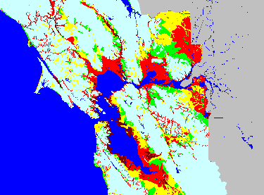
Liquefaction potential map of the San Francisco Bay Area, California. (Image courtesy of the Association of Bay Area Governments-ABAG)
Sources/Usage
Image courtesy of the Association of Bay Area Governments-ABAG