
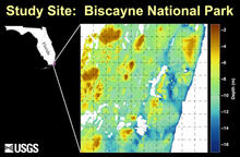
Location and submerged topographic map of the study site

Detailed Description
Location and submerged topographic map of the study site. This 5 km x 5 km area in the southern portion of Biscayne National Park, Florida, was chosen because of its mixture of reef types and the availability of a high-resolution digital-elevation model.
Sources/Usage
Public Domain.
y