
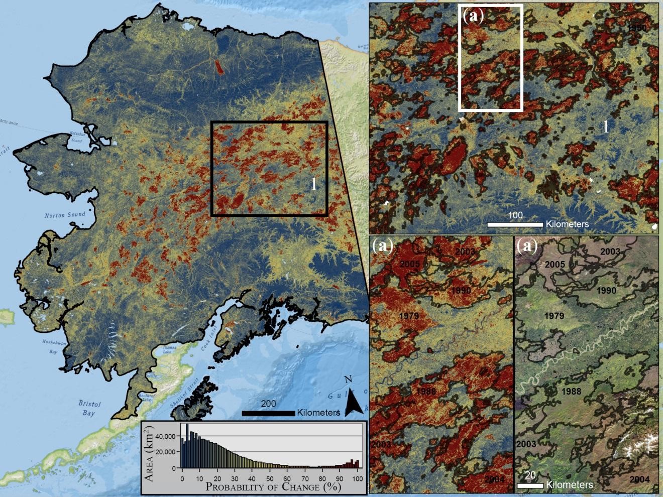
Map of AK showing probability of change occurrence
By Communications and Publishing
2018 (approx.)

Detailed Description
Map of Alaska showing probability (%) of change occurrence. Insets show fire boundaries from the Bureau of Land Management (BLM) Large Fire Database and Landsat 8 imagery (bottom right; 2016) north of Fairbanks, Alaska.
Sources/Usage
Public Domain.