
Map and stratigraphy of ashflow sheets from Yellowstone Hotspot

Detailed Description
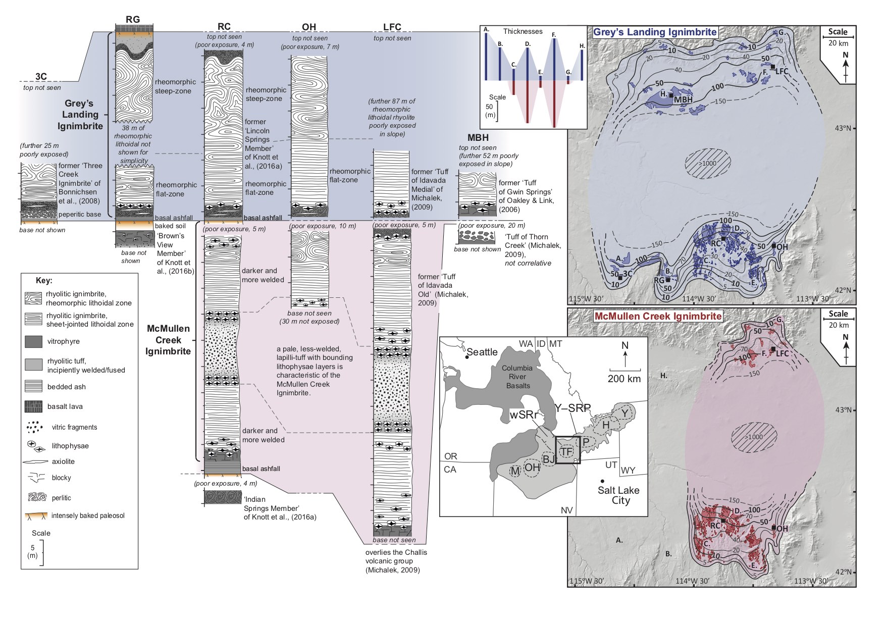
Newly identified ash flow sheets within the Yellowstone–Snake River Plain volcanic province (Y-SRP). The small inset in the center shows the track of the Yellowstone hotspot and its associated eruptive centers in light gray (M—McDermitt; OH—Owyhee-Humboldt; BJ—Bruneau-Jarbidge; TF—Twin Falls; P—Picabo; H—Heise; Y—Yellowstone). On the left are geological logs through the McMullen (red) and Grey’s Landing (blue) super eruption deposits from Twin Falls eruptive center. On the right are distribution maps and the deposit thicknesses (in meters from over 50 logged sites. The areas covered by the distribution maps are given by the black box in the inset map of the Y-SRP volcanic province. Adapted from Knott et al., 2020.
Sources/Usage
Public Domain.