
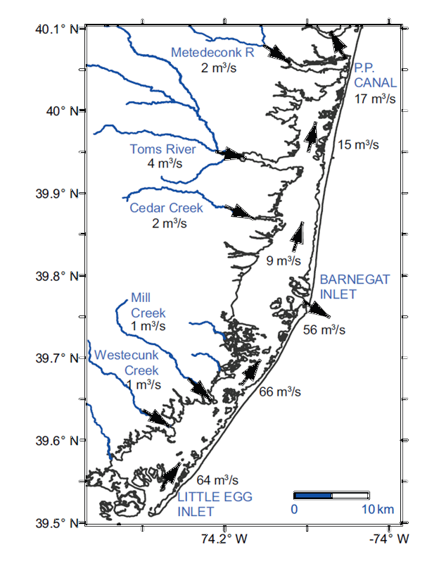
Map of Barnegat Bay showing modeled residual circulation patterns
By Woods Hole Coastal and Marine Science Center
2015 (approx.)
Detailed Description
Map of Barnegat Bay showing modeled residual circulation patterns in that partially explain the long residence time and poorer water quality in the northern portion of the Bay.
Sources/Usage
Public Domain.