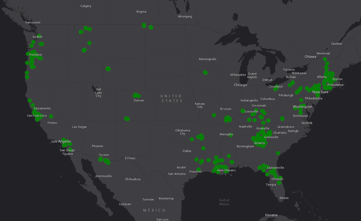
Map of Bsal Surveillance Sampling

Detailed Description
This map shows the sites where Bsal surveillance sampling by the USGS Amphibian Research and Monitoring Initiative has been conducted. Credit: USGS

Official websites use .gov
A .gov website belongs to an official government organization in the United States.
Secure .gov websites use HTTPS
A lock () or https:// means you’ve safely connected to the .gov website. Share sensitive information only on official, secure websites.
This map shows the sites where Bsal surveillance sampling by the USGS Amphibian Research and Monitoring Initiative has been conducted. Credit: USGS