
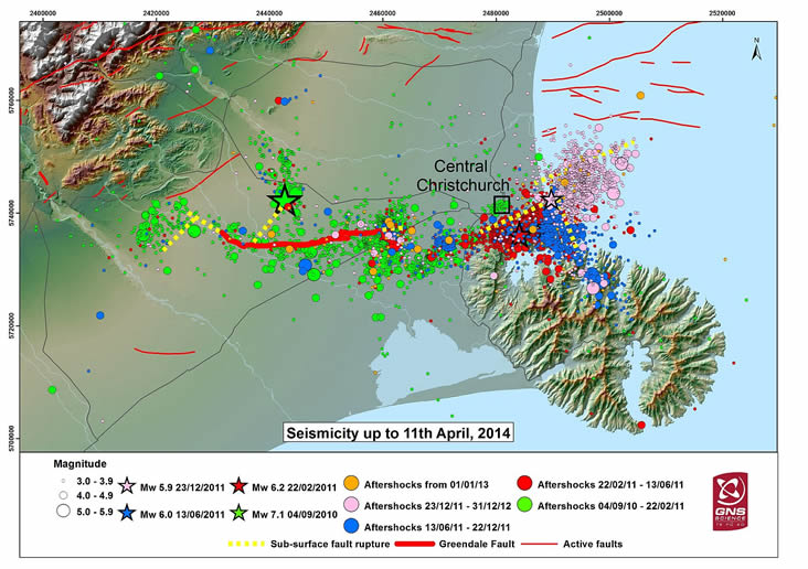
Map of Christ Church, NZ aftershocks
By Western Geographic Science Center
2013 (approx.)

Detailed Description
Map of sesmic activity near Christchurch, New Zealand, from 9/4/2010 to 4/11/2014
Sources/Usage
Public Domain.
Related

Aftershock Forecast Communication for Risk Reduction
Studies of the communication of aftershock information during the Canterbury, New Zealand earthquake sequence conducted by Hazards Societal Consequences and Risk Communication team members and collaborators in New Zealand are examining the use of risk communication products, risk communication strategies, and risk-based decision-making. Focus groups and interviews were conducted with a range of...
Related
Aftershock Forecast Communication for Risk Reduction
Studies of the communication of aftershock information during the Canterbury, New Zealand earthquake sequence conducted by Hazards Societal Consequences and Risk Communication team members and collaborators in New Zealand are examining the use of risk communication products, risk communication strategies, and risk-based decision-making. Focus groups and interviews were conducted with a range of...