
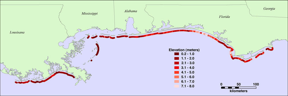
Map of Dhigh, elevations for the barrier islands in the northern Gulf
By St. Petersburg Coastal and Marine Science Center
2010 (approx.)
Detailed Description
Map of Dhigh, elevations for the barrier islands in the northern Gulf of America (Louisiana, Mississippi, Alabama, and Florida's Panhandle). Low elevations, less than 2 m, make Louisiana's barrier beaches vulnerable to extreme coastal change during hurricanes.
Sources/Usage
Public Domain.
Related

Storm-Impact Scale
The potential vulnerability of a particular stretch of coast can be assessed using a conceptual model that scales the impacts of storms on barrier islands.
Related
Storm-Impact Scale
The potential vulnerability of a particular stretch of coast can be assessed using a conceptual model that scales the impacts of storms on barrier islands.