
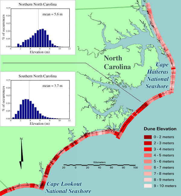
Map of dune elevation for coastal North Carolina

Detailed Description
Map of dune elevation for coastal North Carolina. On the left side of the map are histograms showing the distribution of these 'first line of defense' elevations, one for northern North Carolina and one for southern North Carolina.
Sources/Usage
Public Domain.