
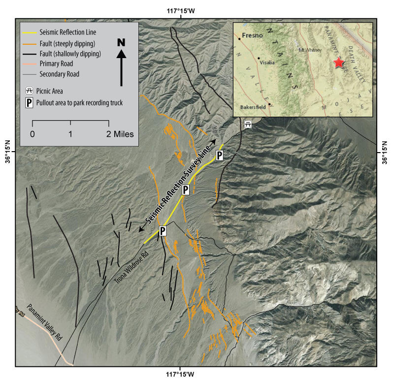
Map of the location of the field study in Panamint Valley, California.
Detailed Description
Map of the location of the field study in Panamint Valley, California. The seismic reflection line is shown in yellow, the low-angle faults are black, and the steep faults are orange.
Sources/Usage
Public Domain.