
Map of Puerto Rico Seismic Activity

Detailed Description
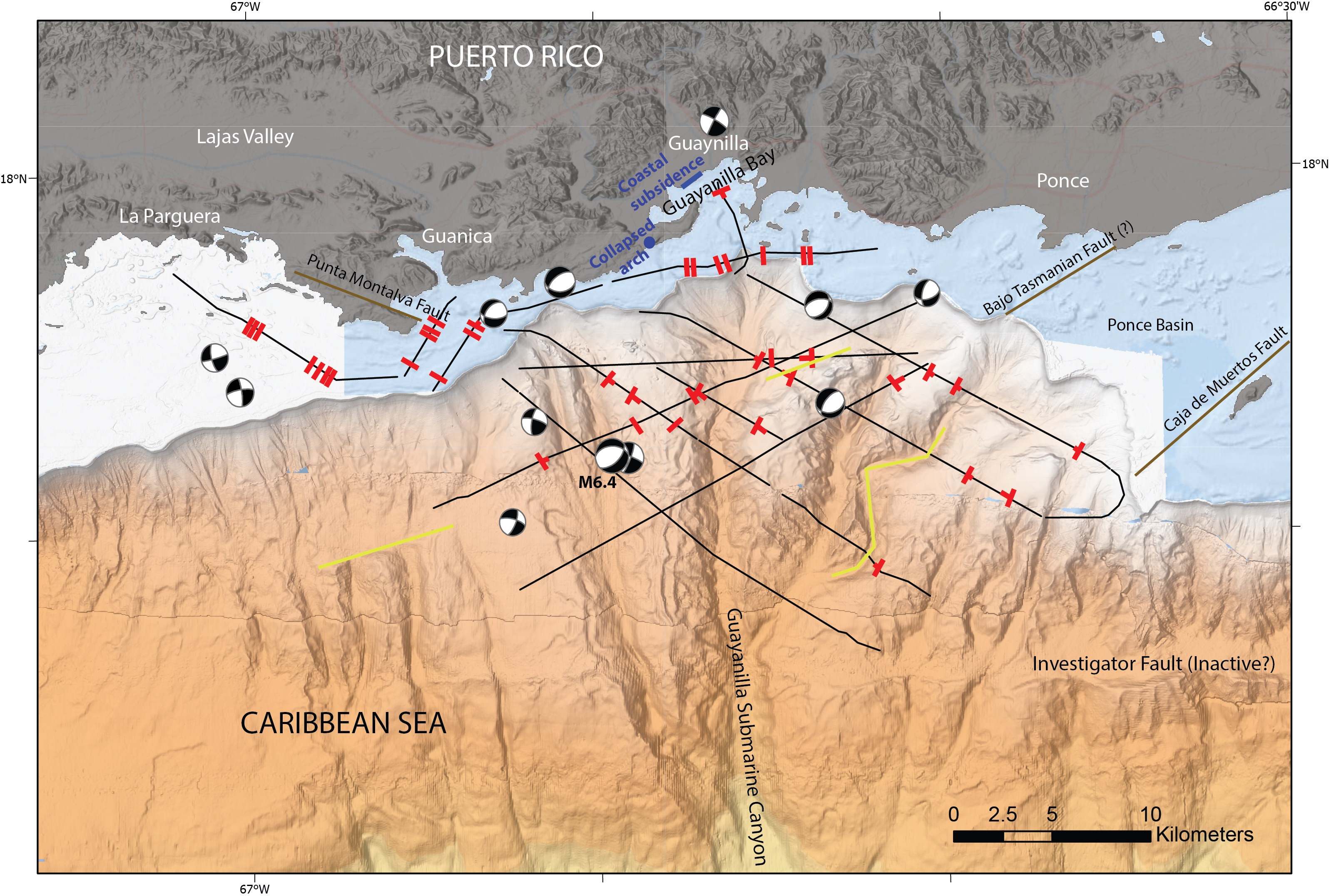
Map of seismic activity in Southwestern Puerto Rico. Twelve Magnitude 5 and larger earthquakes (black and white beach balls on map); more than 250 line-kilometers of high-resolution multichannel sparker seismic reflection data collected during March 7-13, 2020 (black lines on map); identification of numerous faults (red marks on map); unusual seafloor lineaments (marked in yellow on map) are interpreted to have been formed over many millennia.
Sources/Usage
Public Domain.